0330L-SATURDAY OUTLOOK FROM GARFIELD COUNTY EMERGENCY MANAGEMENT-10/09/21
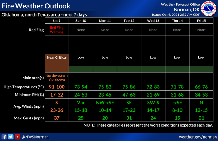
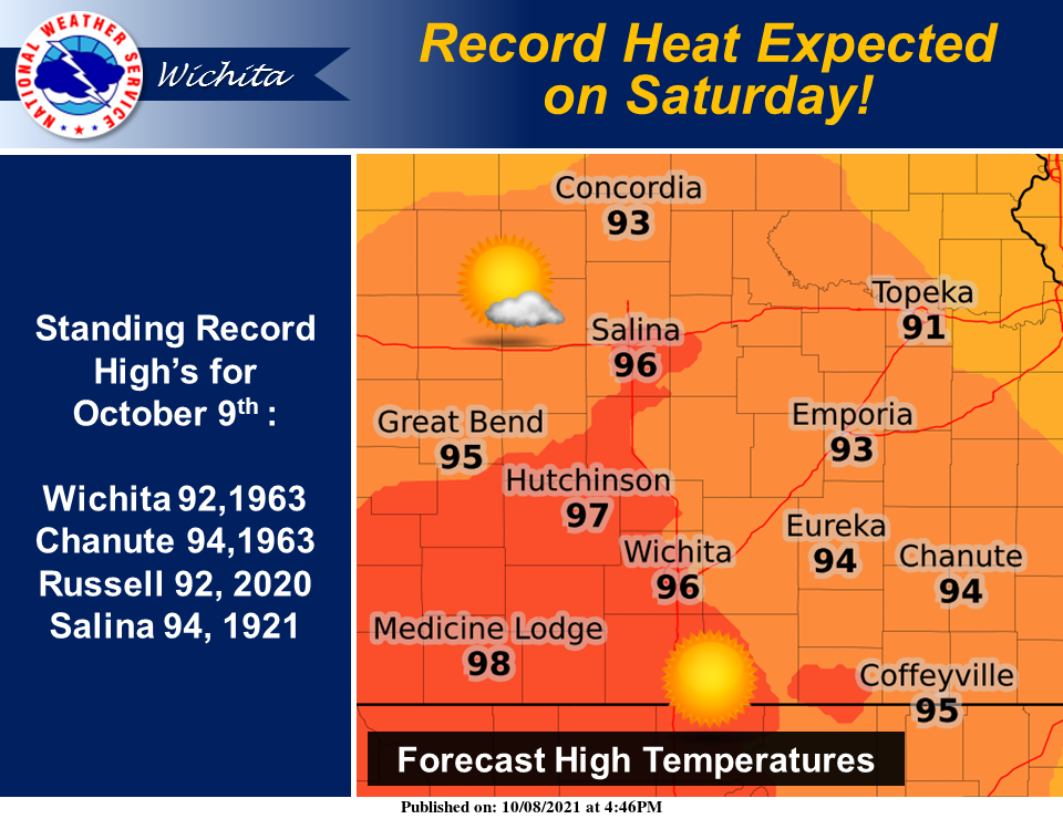
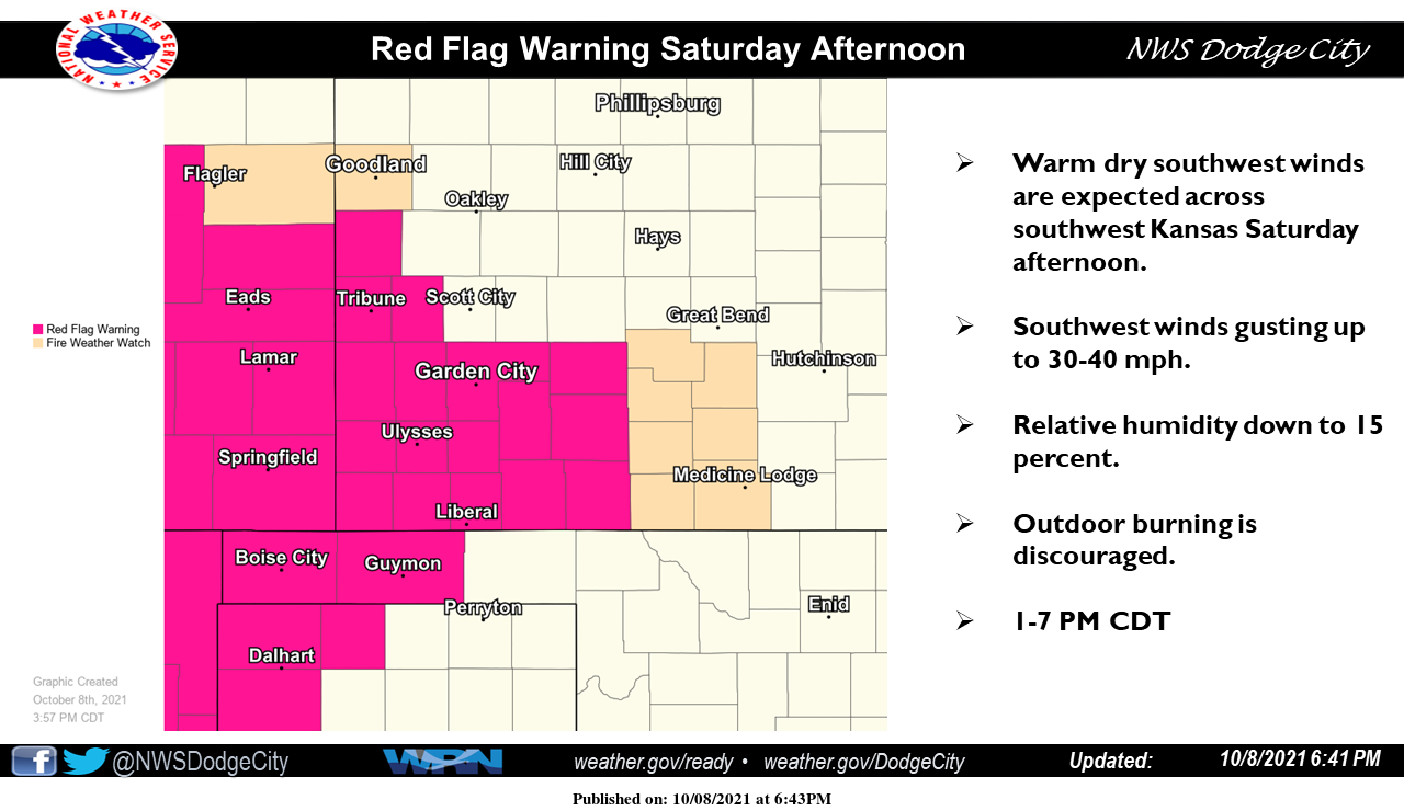
1- HOT & WINDY and temps in the upper 90s along with an increased FIRE DANGER is on the menu for today. Welcome back to summer! As I have asked in the past, no controlled burning today as the word controlled wouldn’t be an option. A RED FLAG FIRE WARNING is in effect in Ellis, Woodward, Harper, & Woods counties. It wouldn’t surprise me to see more counties added as the day progresses. IF you see smoke or fire, call 911 so the proper response can be sent.
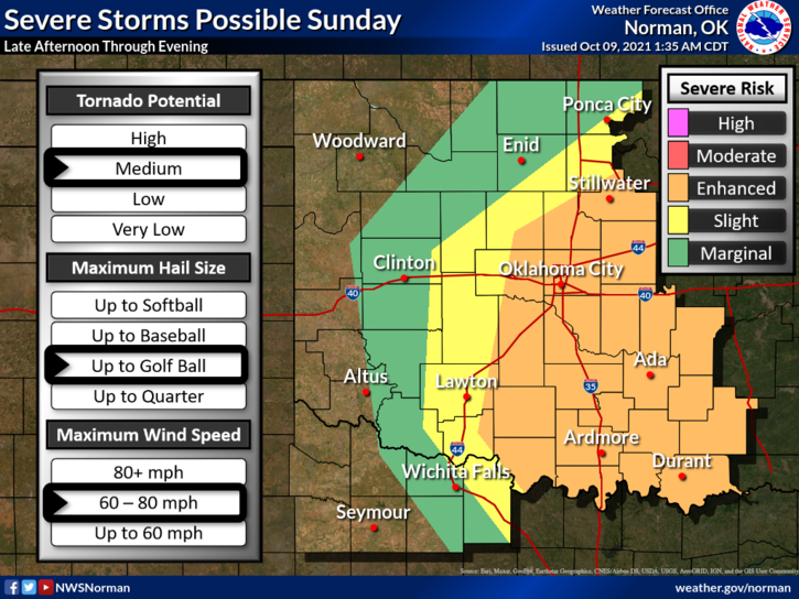
2- WEATHER-WISE: Today’s weather will just be windy, hot, and dirty. Sunday late afternoon into the overnight hours there is a chance we may see some severe weather. There is a cold front, a dryline, a warm front and enough shear in the atmosphere to cause some severe weather. Moisture is limited right now and TIMING is the key element. The graphs attached are a ROUGH idea where things MAY happen. I have briefings later this morning so we’ll see what happens. I may do a live video to update you all around early afternoon.
3- I talk Preparedness all the time. The tv folks talk panic all the time. I am getting many emails and texts about Sunday and Tuesday evenings. DO NOT PANIC. There are lots of variables in the mix. Get our GARFIELD COUNTY EM app and you will get NWS WARNINGS DIRECTLY from them. You’ll also get our info too.
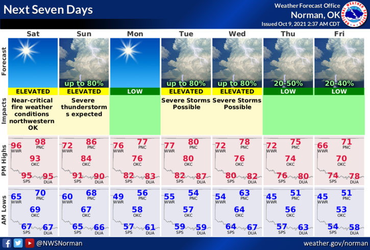
4- Here is your forecast for today;
Today: Partly cloudy in the morning then clearing. Highs in the upper 90s. South winds 15 to 25 mph gusting to 35 mph.
Tonight-Clear. Lows in the mid-60s. South winds 10 to 20 mph gusting to 30 mph.
We’ll advise as needed. STAY SAFE
MIKE