0355L-FRIDAY OUTLOOK FROM GARFIELD COUNTY EMERGENCY MANAGEMENT-10/8/21
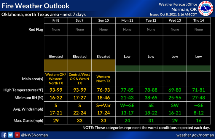
1- Summer temps will creep back in for today and tomorrow along with strong winds. Highs will be in the mid to upper 90s, yes 90s, and winds TODAY will gust upwards of 20-25 mph. Saturday wind gusts will be upwards of 30-36 mph. Humidity will be in the 20’s so we will ask that there be NO outside burning today and Saturday. Barbecuing will be ok as long as you do that over concrete or dirt. Watch out for sparks and be prepared to handle those situations.
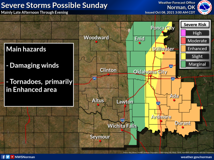
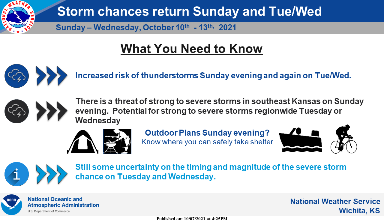
2-Per the FIRE DANGER, If you see smoke and or fire, call 911 immediately and they will get the proper response going. Per SEVERE WEATHER chances for Sunday and then again on Tuesday; There will be a good chance for severe weather on both days most likely late afternoon into the evening hours. Both storm days will depend on storm track and of course timing. We’ll see how later forecasts verify. Either way, as it looks right now the higher impacts COULD be east and southeast of us.
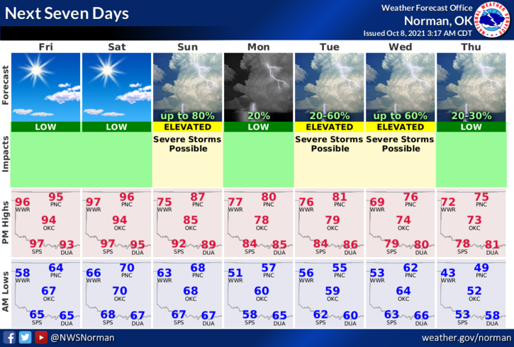
3- Overall, no need to panic either way so for now, keep your eyes peeled on the fire side for now and we’ll also keep an eye out for the rain possibilities. Here is your forecast from the NWS/NORMAN;
Today-Partly cloudy. Highs in the mid-90s. Southwest winds 10 to 15 mph with higher gusts.
Tonight-Partly cloudy. Lows in the upper 60s. South winds 10 to 15 mph with higher gusts.
Download our GARFIELD COUNTY EM app so you can keep up with what’s happening both weather-wise and fire-wise.
STAY SAFE
MIKE