0355L- SATURDAY OUTLOOK FROM GARFIELD COUNTY EMERGENCY MANAGEMENT-10/17/2020
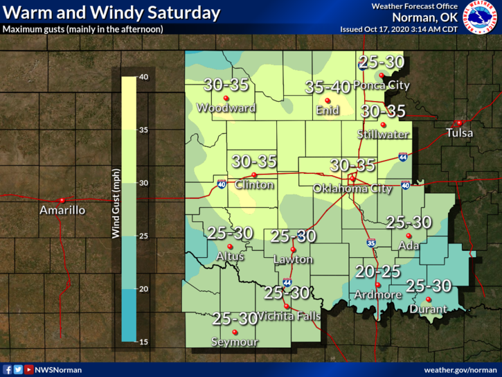
1- Warm and windy today with some gusts upwards of 35-40 mph. The wind gradient is tightening so be cautious of the winds while driving especially on east/west roads.
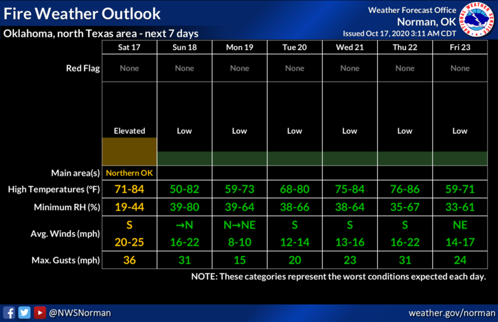
2- The Fire Danger is ELEVATED for us so don’t throw butts out the window and be extremely careful doing anything related to fire. Call 911 if you see smoke or fire.
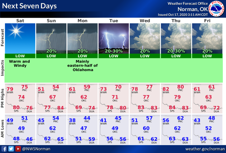
3- Moisture is expected to move north into our area later today which may give us a chance, though slight, for some sort of precipitation ahead of the cold front that should come through the area sometime early Sunday morning. Timing is still a little sketchy per guidance so we’ll wait and see when that occurs. Southerly winds should decrease later today and overnight.
4- After frontal passage, expect increasing northerly winds 10-20 mph with some higher gusts along with cooler temps. Overall, we’ll be ok. Secure lightweight items laying around the yard so they don’t take flight.
Here is your forecast from the NWS/NORMAN;
Today- Sunny. Highs in the mid-70s. South winds 15 to 25 mph with higher gusts.
Tonight- Mostly clear. Lows in the lower 50s. Southeast winds around 10 mph.
HAVE A GOOD DAY!
MIKE