0345L-FRIDAY OUTLOOK FROM GARFIELD COUNTY EMERGENCY MANAGEMENT-10/16/2020
1- WINTER WEATHER ADVISORY in effect for northern NORTH DAKOTA today. I put that in to get you excited that we may see this statement sometime this winter for our area. This would mean that we may see precipitation. There is a chance for some rainfall here but it’s mainly for the eastern half of the state. We can only hope right now.
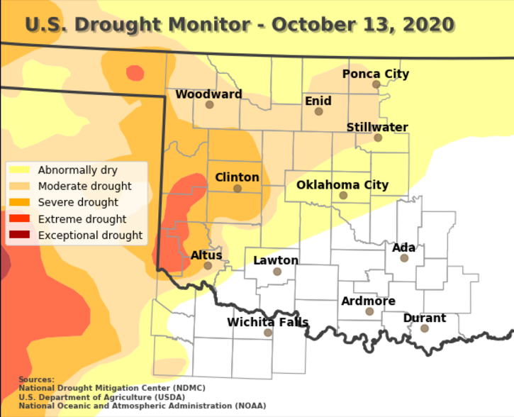
2- The new Drought Monitor is out and the whole county is in a Moderate drought now. Areas to our SW are in a Severe and Extreme Drought. See attached graphic. Our FIRE DANGER is low but if one gets going, it could cause some major issues so if you see smoke or fire, call 911.
3- We are expecting warmer temps tomorrow which will precede another front pushing in and through late Saturday possibly early Sunday. Timing is an issue based on model guidance. It’s slowly getting cooler so keep a jacket or hooded sweatshirt handy. Its also a good time to start disconnecting hoses outside as temps will slowly trend down into the 30s. On clear nights, temps will get colder.
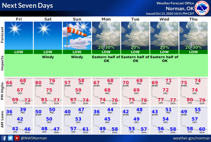
4- Overall, we’ll be ok but we really need some rain. Here is your forecast from the NWS/NORMAN;
Friday- Sunny. Highs in the upper 60s. West winds around 10 mph.
Friday Night- Clear. Lows in the upper 40s. South winds 10 to 20 mph.
HAVE A GREAT DAY!!
MIKE