0355L-SATURDAY OUTLOOK FROM GARFIELD COUNTY EMERGENCY MANAGEMENT-10/22/22
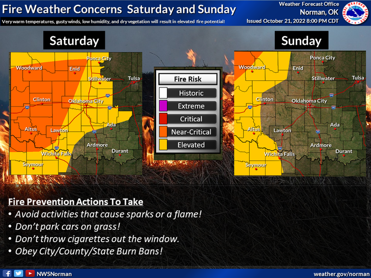
…RED FLAG WARNING IN EFFECT FROM NOON TODAY TO 7 PM CDT THIS EVENING FOR LOW RELATIVE HUMIDITY, DRY FUELS, AND BREEZY CONDITIONS FOR NORTHERN, WESTERN, AND SOUTHWESTERN OKLAHOMA AND WESTERN NORTH TEXAS…
1- Fire Weather continues so we ask that there be NO CONTROLLED BURNS at least for the next few days as they would get out of control quickly in these winds.
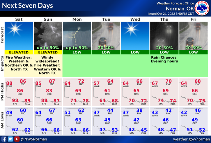
2- We are expecting a strong front to push in on Monday thus the strong wind gradient. Several other factors are involved here too but I won’t go into deep detail. Rain is a low possibility the first of the week. Better chances, per guidance, will be in the southern part of the state.
3- Overall, we’ll be ok so here is your forecast from the NWS/NORMAN
Saturday-Sunny, with a high near 91. Southwest wind 13 to 20 mph, with gusts as high as 30 mph.
Saturday Night-Mostly clear, with a low around 67. South wind 10 to 15 mph, with gusts as high as 23 mph.
FINALLY, KEEP AN EYE OUT FOR ANY SUSPICIOUS ACTIVITY, SMOKE OR FIRE AND CALL 911 IF YOU SEE ANY.
HAVE A GOOD DAY!