0420L-SUNDAY UPDATE FROM ENID/GARFIELD COUNTY EMERGENCY MANAGEMENT-4/22/18
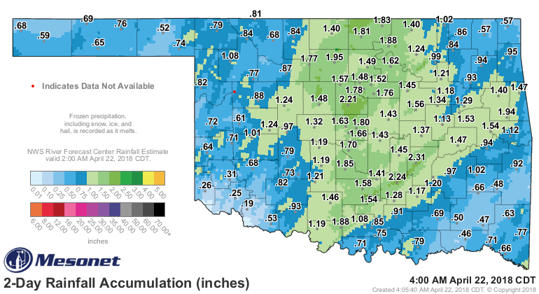
1-THANK YOU ALL for the rainfall totals yesterday. You all can be my official rain gauges on any rain event from now on. No additional training required. Details on the rain gauge team coming sometime this week. Again thank you. By the way, BURN BAN IS STILL IN EFFECT.
2-Based on all the rain totals, 2.5 was the highest in the Bison and Breckinridge areas. 1.5 Near Waukomis and Drummond, 2 inches south of Hennessey, 2 inches in Enid, and ½ inch southwest of Alva. Radar indicated rainfall in the Hunter area was around 5 inches but that HASN’T been verified. These reports are very important for what we call ground truth as radar indicated could be on or off a little.
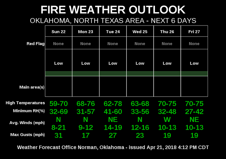
3-According to the forecast, we have several chances for additional rainfall this week. I wouldn’t sweat the severe issue right now as the Storm Prediction Center doesn’t state anything different at this time. Will we have any severe weather this spring? YES but until those parameters set up, DON’T WORRY ABOUT IT. It only causes undo stress and anxiety.
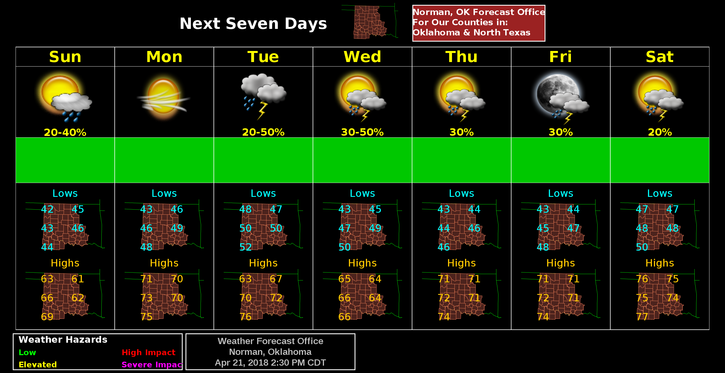
4- Another cool day today so that said, here is your forecast from the NWS/NORMAN;
Sunday-30 percent chance of showers before 7am. Cloudy, with a high near 61. North wind 14 to 18 mph, with gusts as high as 25 mph.
Sunday Night-Mostly cloudy, with a low around 45. North wind 7 to 13 mph.
HAVE A GREAT DAY!!
MIKE