0355L-SUNDAY OUTLOOK & INFO FROM GARFIELD COUNTY EMERGENCY MGMT-4/26/2020
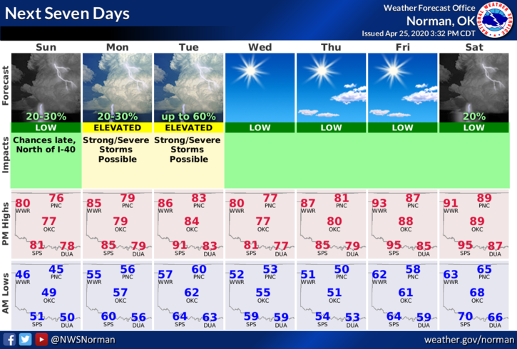
1- We remain in a GENERAL Thunderstorm Risk area. This doesn’t mean we’ll see thunderstorms all the time, it only means the potential is there if conditions are just right. Those conditions may be close late Sunday night as a trough/front pushes through the area. We’ll see what happens. Here’s your forecast from the NWS/NORMAN;
Today-Partly cloudy. Highs around 80. Southwest winds up to 15 mph shifting to the south in the afternoon.
Tonight-Partly cloudy. A chance of thunderstorms after midnight. Warmer. Lows in the upper 50s. South winds 10 to 15 mph. Chance of thunderstorms 30 percent.
Leaving this short and sweet for Sunday.
HAVE A GREAT DAY!!
MIKE