0355L-SUNDAY OUTLOOK & INFO FROM GARFIELD COUNTY EMERGENCY MANAGEMENT-8/11/19
Keep up with the latest watches, warnings, and advisories directly from the NWS & GCEM through our GARFIELD COUNTY EM app. If you don’t have it, YOU are NOT prepared!
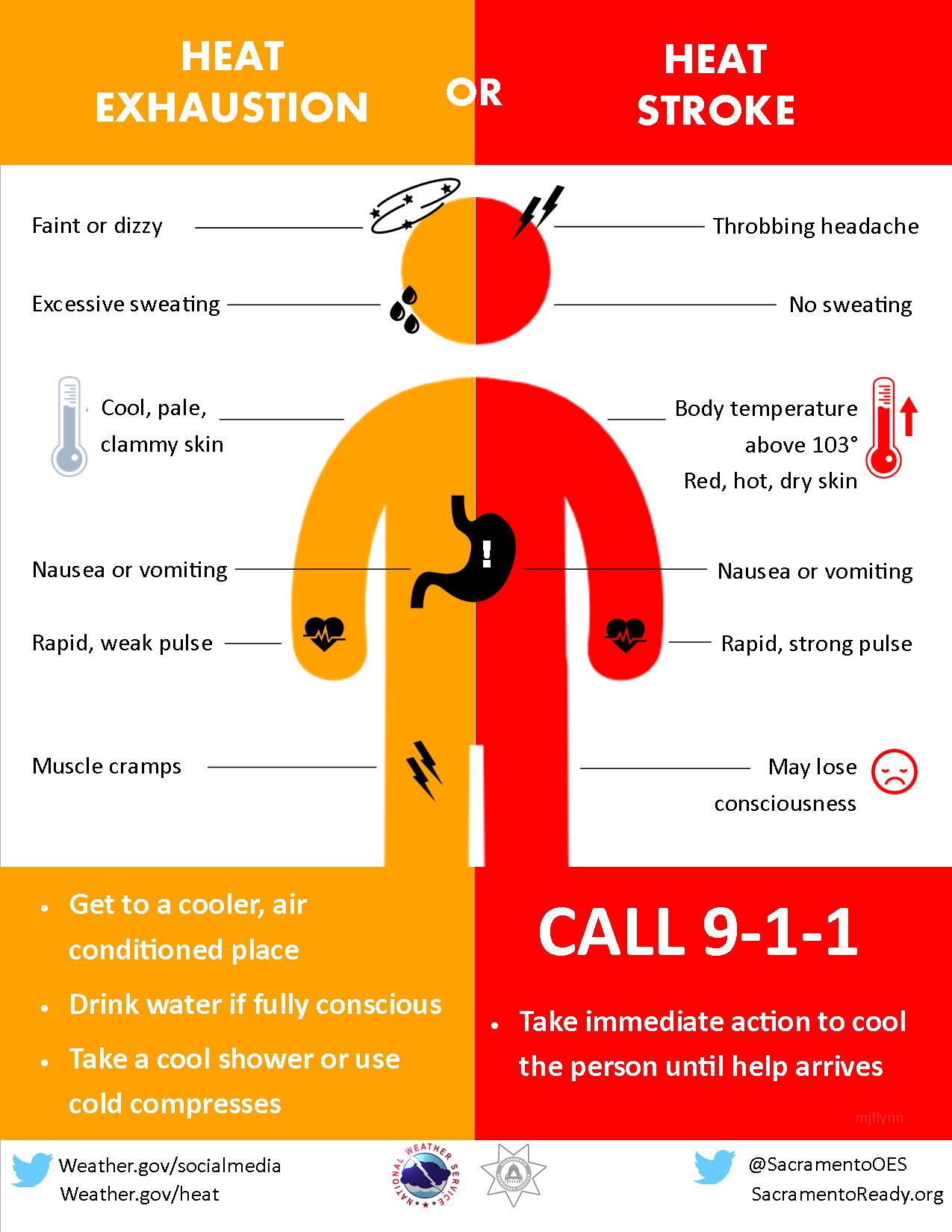
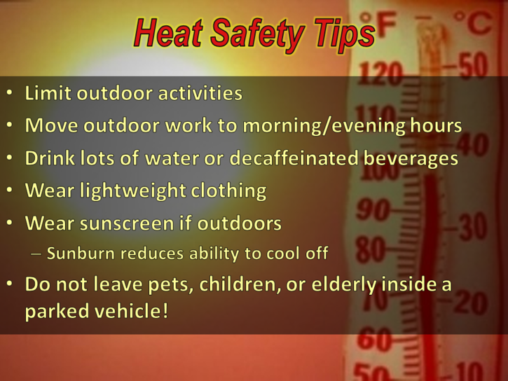
1- HEAT ADVISORY IN EFFECT UNTIL “MONDAY EVENING” AT 8PM. As I have been stating for quite some time, STAY HYDRATED!! Under these conditions the heat CAN overtake you when you least expect it. Water and Gatorade “type” products in moderation along with rest is the best route to take. Don’t drink pop or energy products. They will hurt you in excessive heat.
2- Severe weather is back in the forecast for the area late Monday. Wind and hail look to be the main threats for now. Will watch and advise.
3- Overall, stay cool and if you don’t have to work outside, go swimming if you can or just stay inside.
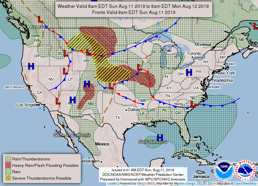
4- Here is your forecast from the NWS/NORMAN;
Sunday- Hot with highs near 104. Heat index values as high as 107. South winds 5 to 15 mph.
Sunday Night-Lows in the upper 70s with south-southeast winds 10-15 mph.
HAVE A SUPER DAY!!
MIKE