0425L-MONDAY OUTLOOK & INFO FROM GARFIELD COUNTY EMERGENCY MANAGEMENT 8/12/19
NO STORM SIREN TEST IN ENID TODAY.
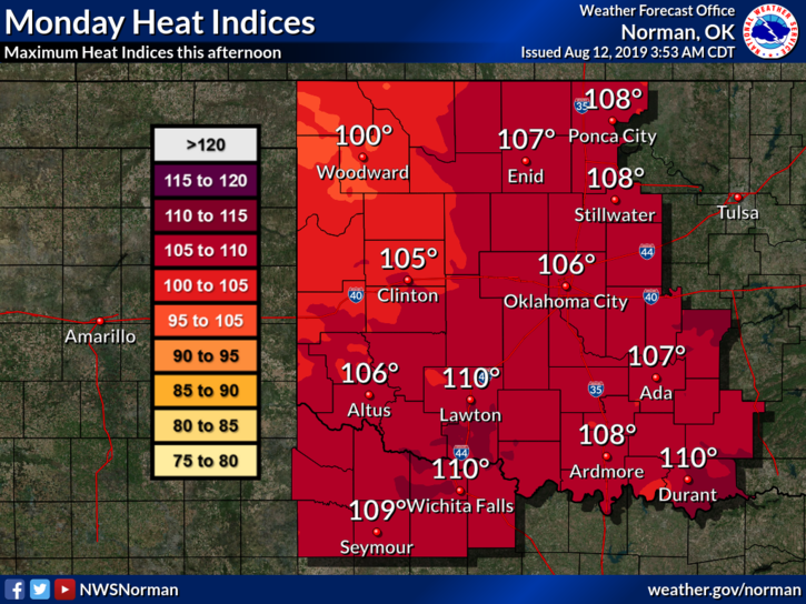
1- HEAT ADVISORY remains in effect through 8pm this evening. Keep up with the protocol of staying hydrated. The heat WILL HURT YOU if you are not careful!
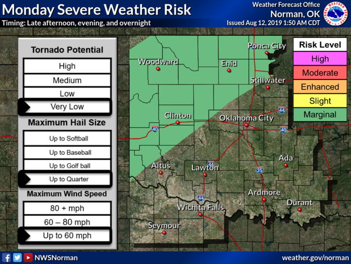
2- MARGINAL RISK for severe weather later today and tonight. If storms occur, wind and hail will be the main threats. This is due to a cold front that will push in later and thus cooling us down a little. Tuesdays high will be somewhere in the upper 80s to low 90s.
3-COMMENT- As we continue with the heat of summer, now is a good time to be thinking about winter. We have had some mild winters but we’ve also had some pretty tough ones too. Be thinking about what work may need to be done around the house to make sure you don’t lose heat in the house. Heat may be coming in now so seal those areas off and you will have solved the leaked air problem. That wasn’t hard, was it?
4- Overall, stay in as much as possible and if you have to work outside, pace yourselves and take frequent breaks. Stay weather aware later this afternoon too.
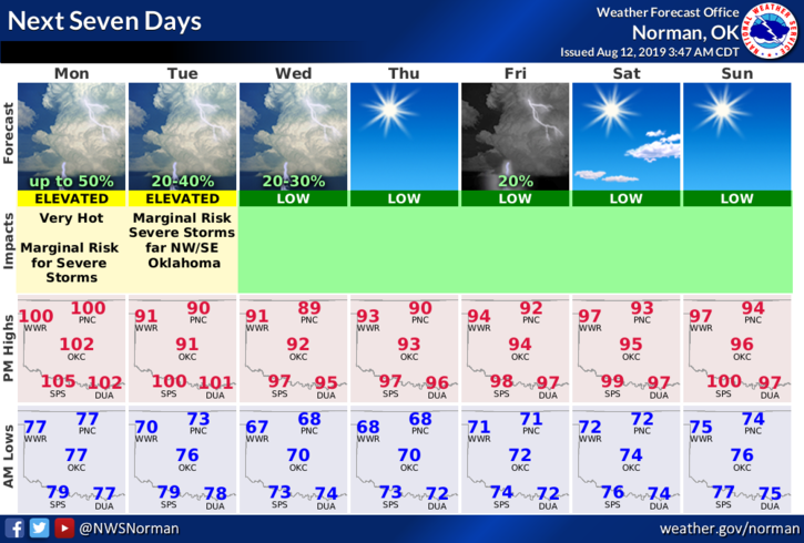
5- Here is your forecast from the NWS/NORMAN;
Monday-Sunny and hot with a high near 104. Heat index values as high as 110. South southwest wind 10 to 15 mph gusting to 20 mph.
Monday Night-40 percent chance of showers and thunderstorms, mainly after 1am. Mostly cloudy with a low around 73. South wind 5 to 10 mph becoming north northwest after midnight.
HAVE A SUPER DAY!!
MIKE