FROM GARFIELD COUNTY EMERGENCY MANAGEMENT-SUNDAY 8/27/17
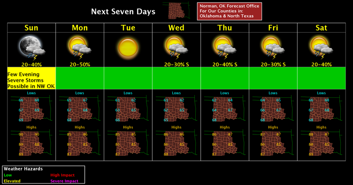
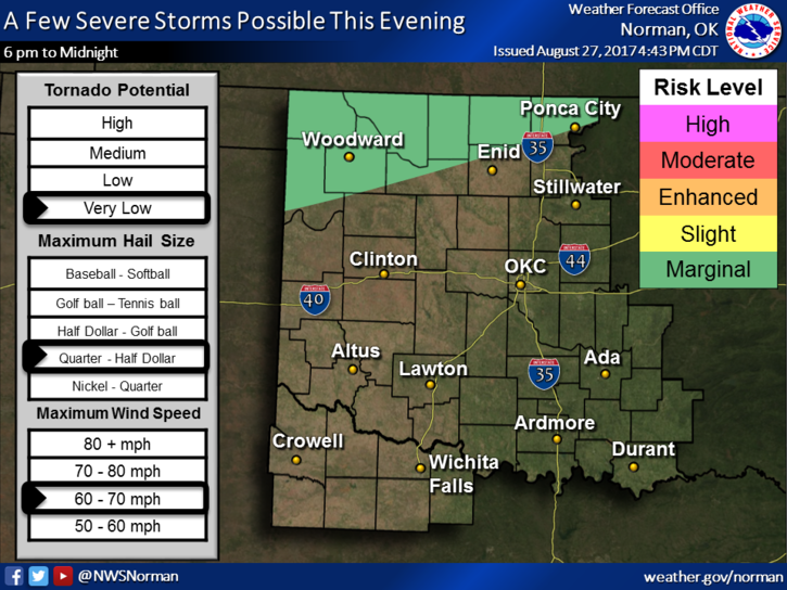
There is a chance for thunderstorms later today as a cold front moves into the northern portion of the state. Even though the lines don’t show us completely in the marginal risk area, we could still see some activity later in the day. Just stay weather aware and we’ll be ok. If anything changes, I’ll advise accordingly.Other than that, a warm day on tap so get out and enjoy. Here is your forecast from the NWS/NORMAN;
Sunday-Mostly sunny, with a high near 90. Southeast wind 3 to 6 mph.
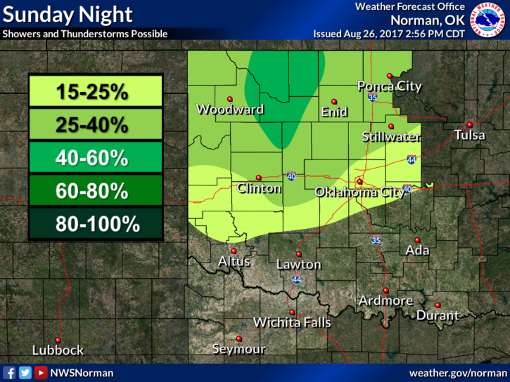
Sunday Night-30 percent chance of showers and thunderstorms. Mostly cloudy, with a low around 67. East southeast wind around 7 mph becoming northeast after midnight.
HAVE A SUPER DAY!!
MIKE