0410L-SUNDAY OUTLOOK FROM GARFIELD COUNTY EMERGENCY MANAGEMENT-8/7/22
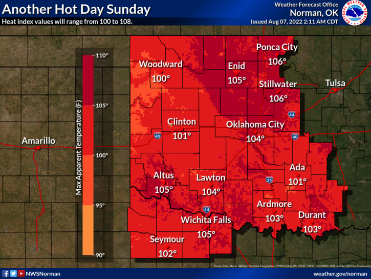
1- HEAT ADVISORY FROM 12 NOON TODAY UNTIL 8PM THIS EVENING.
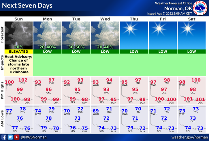
2- One more day of 100+ temps for awhile and then chances for rain as a front tries to push into the area. Per guidance, it isn’t clear where the front may end up today or tomorrow. What is clear is that we have additional chances for rain through mid-week. We’ll see what happens.
3- Here is your forecast from the NWS/NORMAN;
Today-Sunny, hot with highs around 103. South winds 10 to 15 mph with higher gusts.
Tonight-Partly cloudy in the evening, then mostly cloudy with a slight chance of showers and thunderstorms after midnight. Lows in the upper 70s. South winds 10 to 15 mph. Chance of rain 20 percent. Heat index values up to 105 early in the evening.
4- Overall, we’ll be toasty for one more day, then a bit cooler.
HAVE A GOOD DAY.