0410L FROM GARFIELD COUNTY EMERGENCY MANAGEMENT-SUNDAY-12/03/17
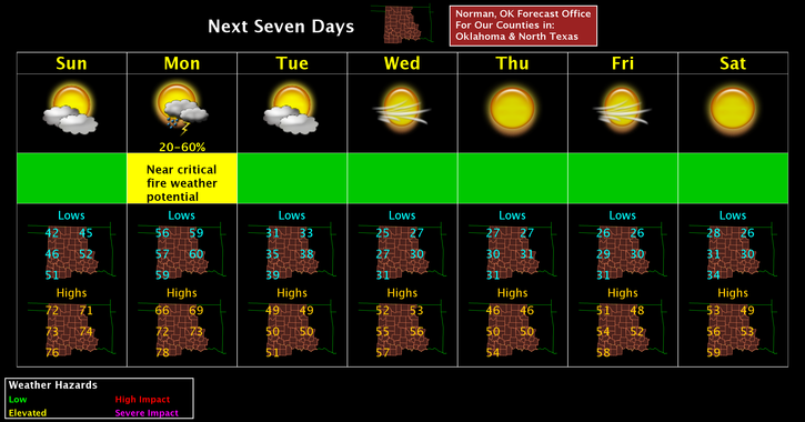
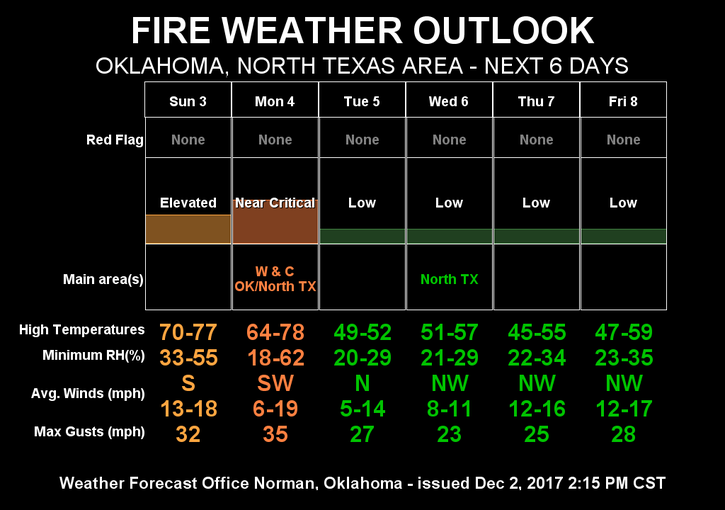
WINDY AND WARM TODAY AND TOMORROW, THEN COLDER! By mid-week, we will get dramatically colder. NO rain or winter precipitation is expected this week around here at all. This said, here is your forecast from the NWS/NORMAN;
Sunday-Patchy fog before 8am then partly sunny with a high near 70. Light and variable wind becoming south 12 to 17 mph in the morning. Winds could gust as high as 24 mph.
Sunday Night-Partly cloudy, with a low around 58. South wind 14 to 20 mph, with gusts as high as 28 mph
Download our emergency app “GARFIELD COUNTY EM” Learn how it works now while nothing major is happening. When an event occurs, you’ll know how it works.
FIRE DANGER IS ELEVATED TODAY!! BE CAREFUL!
HAVE A GREAT DAY!!
MIKE