FROM GARFIELD COUNTY EMERGENCY MANAGEMENT-MONDAY-12/04/17
BE SURE TO DOWNLOAD OUR APP- GARFIELD COUNTY EM.
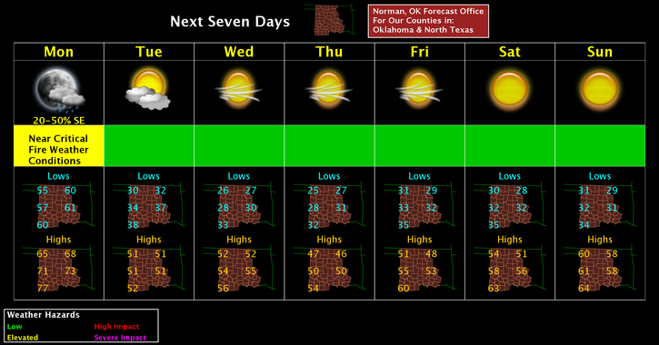
A cold front is on the way and should arrive here sometime this afternoon. Timing is an issue but it will eventually arrive. Winds and temps will be the main issues as we work through the week. Overall we’ll get colder but no major issues to be concerned with right now. I would definitely keep a jacket handy as we’ll see temps in the upper 40’s and 50’s for highs this week and 20’s and 30’s for lows.
Here is your forecast from the NWS/NORMAN;
Monday- partly cloudy with highs in the upper 60s. Southwest winds around 20 mph shifting to the northwest in the afternoon.
Monday night-Partly cloudy and much colder with lows in the lower 30s. North winds 10 to 20 mph with higher gusts.
REMEMBER-TRUST YOUR SOURCE FOR WEATHER INFORMATION. THERE ARE FRAUDULENT SOURCES OUT THERE.
HAVE A GREAT DAY!!
MIKE