0400L-SUNDAY OUTLOOK FROM GARFIELD COUNTY EMERGENCY MANAGEMENT-12/05/21
1- Changes are coming for the colder. Today, the roller coaster warms us back up around 70 then a cold front will push in later this afternoon into the early evening and bring with it very strong winds and colder air. The wind gradient tightens during the day today as this front approaches. Secure anything that could take flight out of the yard. No rain should occur with this front, at least here.
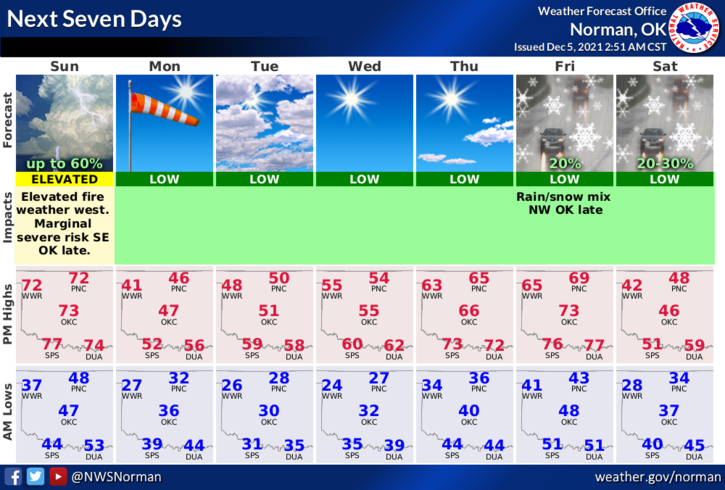
2- There is a chance for POSSIBLY some wintry weather around the end of the week but it’s too soon to get our hopes up yet. Here is your forecast from the NWS/NORMAN;
Sunday-Patchy fog before 8am. Otherwise, sunny, with a high near 72. Southwest wind 10 to 20 mph, with gusts as high as 26 mph.
Sunday Night-Mostly clear, with a low around 30. West southwest wind 10 to 15 mph becoming north 15 to 25 mph in the evening. Winds could gust as high as 34 mph.
REMEMBER to get our GARFIELD COUNTY EM app. It not only will keep you safe with info from us and the NWS, but it just could also save your life.
STAY SAFE