0405L-SUNDAY OUTLOOK AND INFO FROM GARFIELD COUNTY EMERGENCY MANAGEMENT-2/10/19
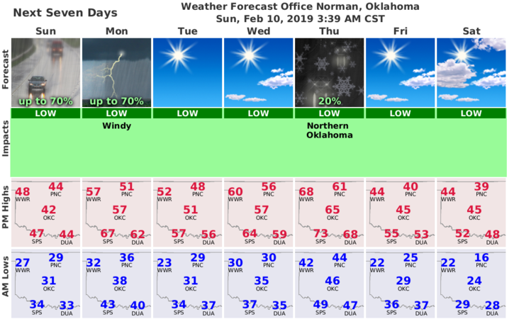
1) A mostly dreary day with some light precipitation. Add wind to the mix and you have a movie day in the living room. No thunderstorms expected either so enjoy the shows!
2) We will gradually warm-up this week until we see another cool down for next weekend. Until then, rain chances are possible off and on this week.
3) FOOD FOR THOUGHT: Folks state they are ready for anything until something actually occurs. If you were ordered, and I hate to put it this way, to stay at home for 7 days, could you do this and have plenty of food for EVERYONE at home? If not, you’re NOT ready.
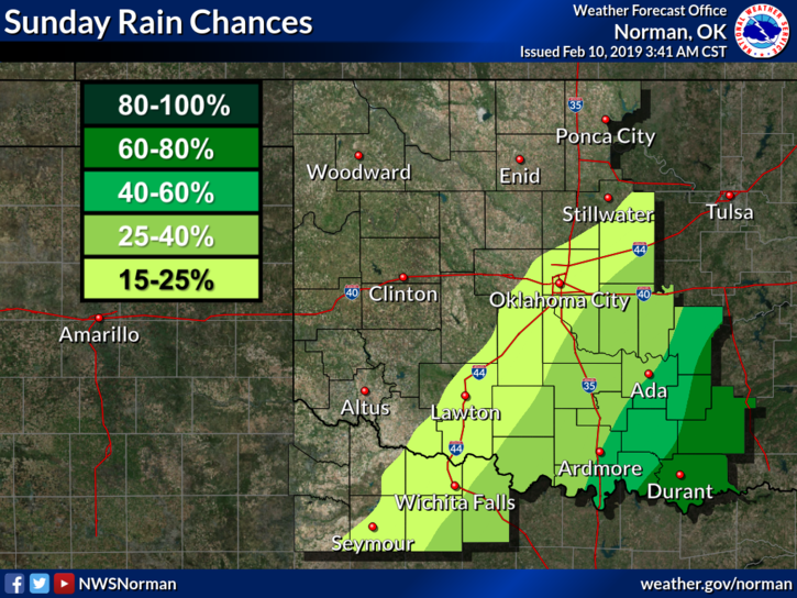
4) Here’s your forecast from the NWS/NORMAN;
Sunday-Areas of drizzle or freezing drizzle before 9am, then areas of drizzle between 9am and noon. Cloudy with a high near 45. South winds 10 to 15 mph gusting as high as 25 mph.
Sunday Night-Areas of drizzle between 9pm and midnight, then areas of drizzle with a slight chance of rain after midnight. Cloudy with a low around 36. South winds 5 to 10 mph. Chance of precipitation is 20%.
HAVE A SUPER DAY!!
MIKE