0350L-MONDAY OUTLOOK & INFO FROM ENID/GARFIELD COUNTY EMERGENCY MANAGEMENT-2/11/19
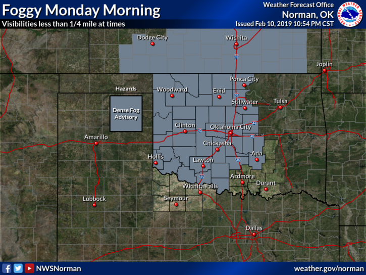
1) DENSE FOG ADVISORY IN EFFECT UNTIL 10 AM. Visibility may be reduced to ¼ mile at times. Slow down while driving. We’ll have a cold front push into the area later tonight.
2) Here is your forecast from the NWS/NORMAN;
Monday-Cloudy. Areas of dense fog in the morning. A slight chance of rain in the morning, then a slight chance of thunderstorms in the afternoon. Not as cool. Highs in the upper 50s. South winds 10 to 15 mph. Chance of precipitation 20 percent.
Monday Night-Partly cloudy. A chance of rain showers and a slight chance of thunderstorms in the evening. Lows in the upper 20s. Northwest winds 15 to 25 mph. Chance of precipitation 40 percent.
3) NOW FOR THE INFO; on our “GARFIELD COUNTY EM” app we have a scroller with 4 pics on the front page. If you have any weather or disaster pics from our area and would allow us to use them, email them to mike@gcem.org along with a statement of permission. You don’t get a prize if we use them but just add your name in the lower right hand corner and we’ll know who took them. Thank you.
HAVE A SUPER DAY!!
MIKE