0315L-SUNDAY OUTLOOK FROM GARFIELD COUNTY EMERGENCY MANAGEMENT 02/11/24
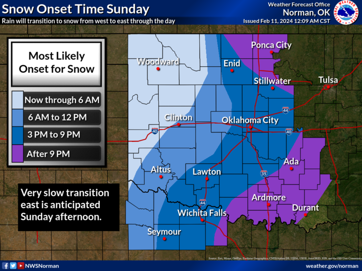
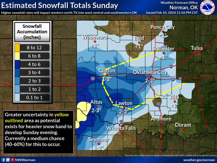
*The forecast seems to keep changing some so here it is, we will most likely have some shower activity today and tonight and as we move into and near freezing, we’ll see some snow. How much snow? Again, storm track is important. Per guidance, in our area, we may see only 1 inch or less. If the track deviates northward, we could receive more. This is about it right now. It’s a waiting game.
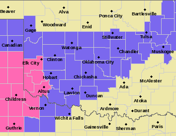
*There is a Winter Weather Advisory in effect for areas in Oklahoma south of a Gage to Kingfisher to Stillwater to Tulsa line. We’ll see what happens. Overall, we’ll be ok so if we see rain and then transition to snow and you are out driving, slow down and stay safe. Here is your forecast from the NWS/NORMAN;
Today- Cloudy. A chance of rain and snow showers this morning, then rain showers likely this afternoon. Highs in the lower 40s. North winds 15 to 20 mph with gusts up to 30 mph. Chance of precipitation 70 percent.
Tonight- Mostly cloudy with snow showers likely. Rain showers likely, mainly in the evening. Snow accumulation up to 1 inch. Cold with lows in the lower 30s. North winds 10 to 15 mph with gusts up to 25 mph. Chance of precipitation 70 percent.
*Here is a link to the NWS/NORMAN website- https://www.weather.gov/oun/ The graphics attached to this post will change a few times so check in with the NWS. Also, download our GARFIELD COUNTY EM app.
HAVE A GOOD DAY!