FROM GARFIELD COUNTY EMERGENCY MANAGEMENT-SUNDAY JULY 23, 2017
At 0415 this morning, a strong thunderstorm is located over the Garber area. Heavy rainfall and strong winds are the primary risks with this cell. It’s moving to the ENE around 20 mph.
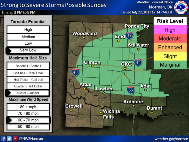
An outflow boundary in the Garfield County area will be a focal point as the day progresses for more convective activity. Basically, we stand a better chance for rain today than we did yesterday. We are in a MARGINAL RISK for severe weather with wind and hail being the primary threats. We’ll just wait and see where things line up as the day wears on.
Here is your forecast from the NWS/NORMAN;
Sunday-40 percent chance of showers and thunderstorms after 8am. Mostly sunny and hot, with a high near 99. Heat index values as high as 104. East southeast wind 6 to 9 mph becoming northeast in the morning.
Sunday Night-40 percent chance of showers and thunderstorms before 2am. Mostly cloudy, with a low around 73. East southeast wind 5 to 13 mph.
Have a super day and stay cool.
MIKE