0400L-SUNDAY OUTLOOK FROM GARFIELD COUNTY EMERGENCY MGT-7/26/2020
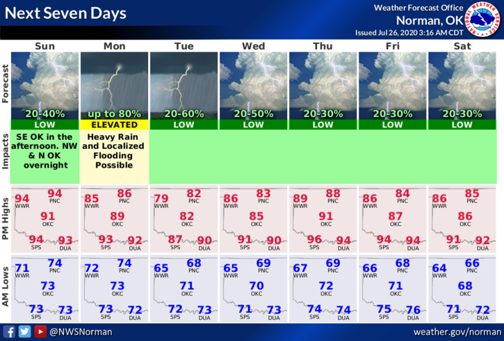
1-We are in a GENERAL THUNDERSTORM RISK area later today into tonight. Tonight’s percentage is 20%. Monday is 70-80% and then 20-30% for the next 5 days. This is July right? Keep in mind that we did receive 4+ inches of rain last Tuesday but much of that did run off. We’ll see what happens this week with rainfall as several storm systems move through.
2-Continue to keep the kids out of the creeks as there are snakes and other critters lurking. When it starts to rain, it won’t take long for those creeks and other tributaries to fill so again, warn your kids about the creek issues.
3- Here is your forecast from the NWS/NORMAN;
Today-Partly cloudy. Highs in the mid-90s. South winds around 10 mph. Heat index near 100.
Tonight-Partly cloudy. A slight chance of thunderstorms after midnight. Lows in the lower 70s. South winds around 10 mph. Chance of thunderstorms 20 percent.
HAVE A GOOD DAY!!
MIKE