0400L-MONDAY OUTLOOK & INFO FROM GARFIELD COUNTY EMERGENCY MGMT-7/27/2020
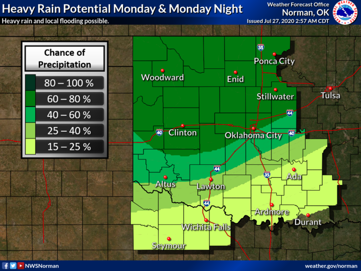
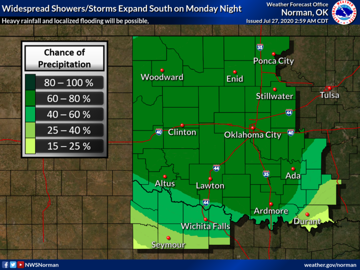
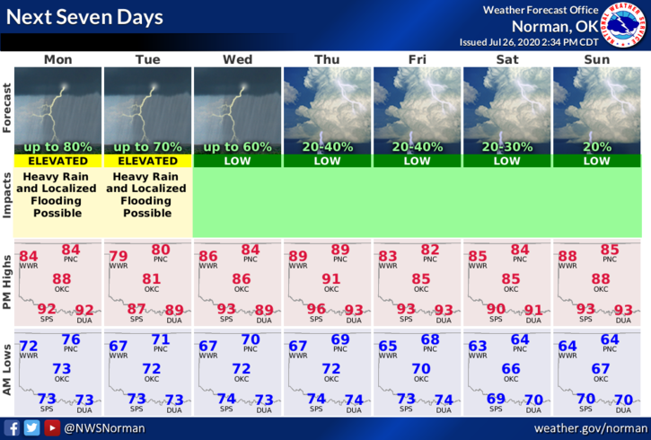
1-RAIN in the forecast all this week starting today. Thunderstorms ongoing in southern Kansas may affect the area as the morning wears on. These storms are not severe but impressive rain producers. Overall, we can expect heavy rainfall, gusty winds, and the possibility of flooding especially in low lying areas if high precipitation does happen. We’ll see where the heavy rainfall occurs. In between storms, remember to keep the kids out of the tributaries and larger creeks as snakes and other critters may be lurking in those areas.
2- Temperature-wise, we will most likely stay a little below normal during the week with high rain chances around the area so enjoy the cooler weather while you can. The heat will return as we move into August.
3- Here is your forecast from the NWS/NORMAN;
Monday-Cloudy with a 70% chance for thunderstorms. Highs in the upper 80s. Southwest winds around 10 mph shifting to the north in the afternoon. Chance of precipitation 70 percent.
Monday Night-Cloudy with a 70% chance for showers and thunderstorms. Lows in the upper 60s. Light and variable winds. Chance of precipitation 70 percent.
HAVE A GOOD DAY!!
MIKE