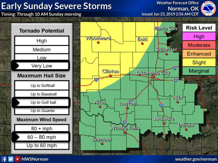
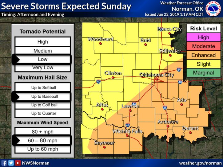
0345L-SUNDAY OUTLOOK FROM GARFIELD COUNTY EMERGENCY MANAGEMENT-6/23/19
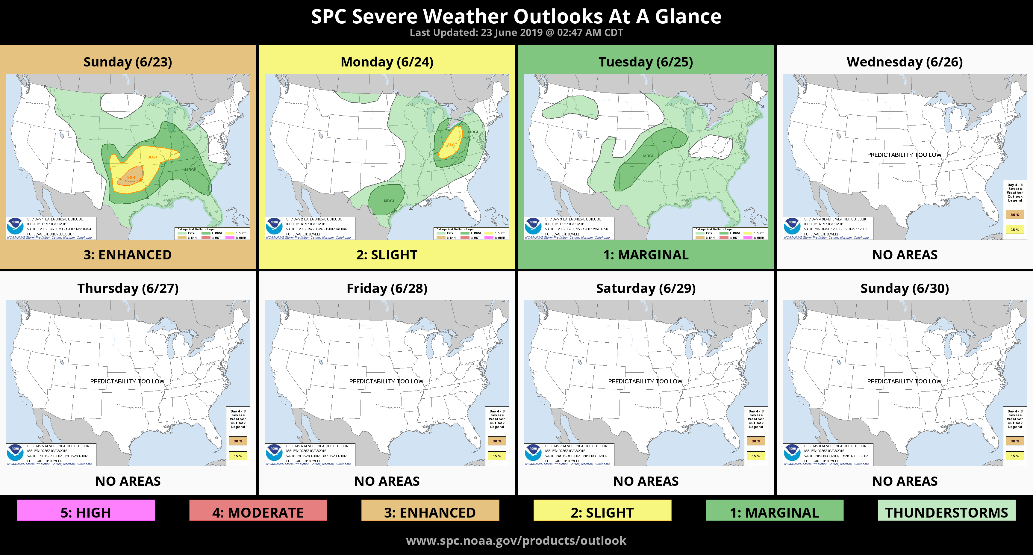
1- SLIGHT RISK FOR SEVERE WEATHER TODAY. THE FLOOD WATCH HAS BEEN EXTENDED UNTIL 7 AM MONDAY MORNING. SEVERE T-STORM WATCH UNTIL 10 AM.
2- The front is still taking it’s time moving this way so it should start that move this morning. Showers and storms will begin to affect the area early today so once they do, heavy rainfall, hail, and damaging winds will be our main threats. Torrential rainfall from training storms will be a factor “if” we end up in that pattern. Be careful driving if this happens, especially in low lying areas.
3-We’ll wait and see how this mess comes together. Here is your forecast from the NWS/NORMAN;
Sunday-Showers and thunderstorms likely, mainly before 10am. Some of the storms could be severe and produce heavy rainfall. Mostly cloudy, with a high near 88. South wind 10 to 15 mph becoming northwest in the afternoon. Chance of precipitation is 60%.
Sunday Night-30 percent chance of showers and thunderstorms before 1am. Some of the storms could be severe. Partly cloudy, with a low around 61. Northwest wind 5 to 10 mph.
WE’LL KEEP AN EYE OUT AND ADVISE AS NEEDED.
MIKE