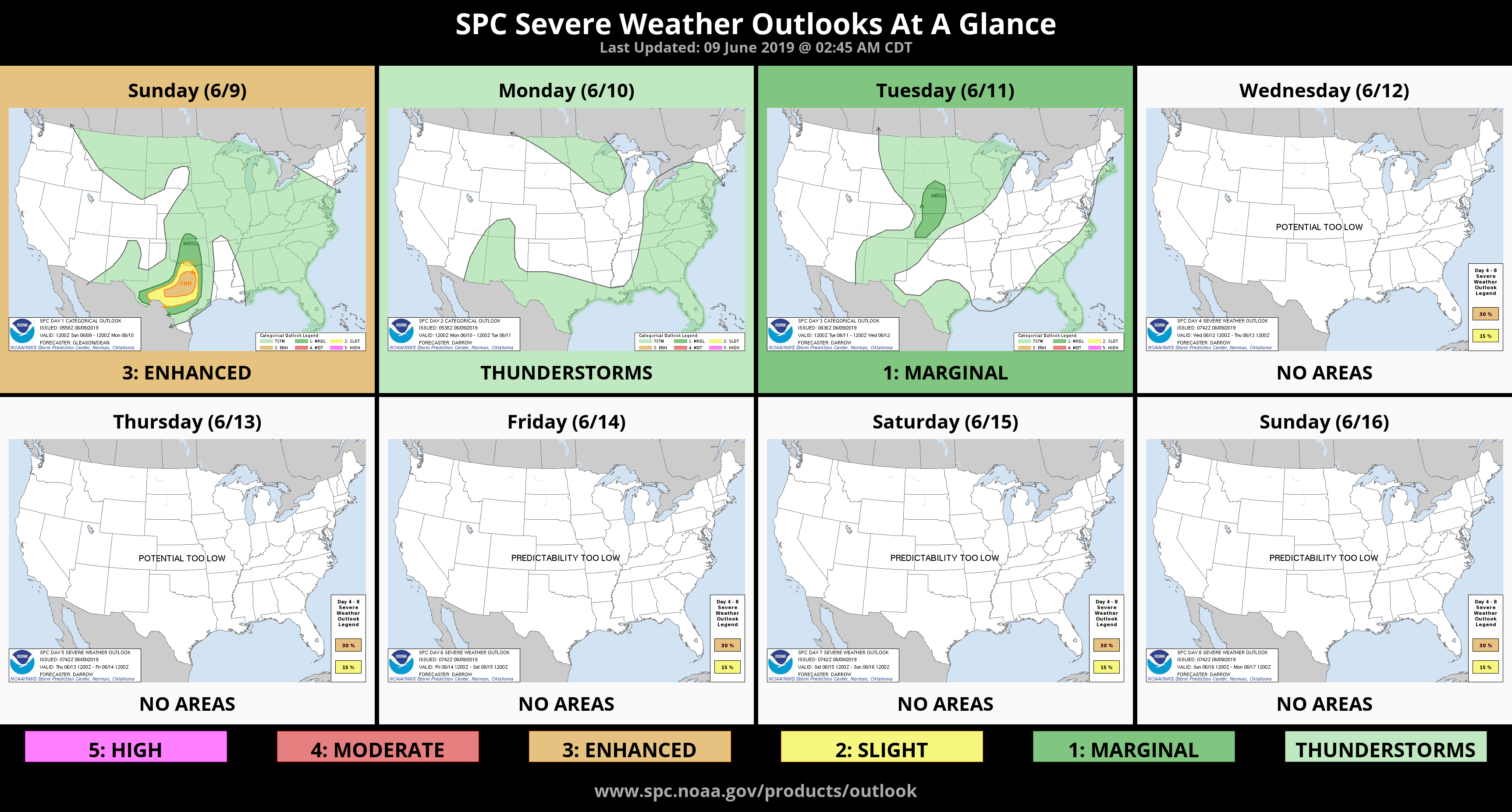
0420L-SUNDAY OUTLOOK FROM GARFIELD COUNTY EMERGENCY MANAGEMENT-6/9/19
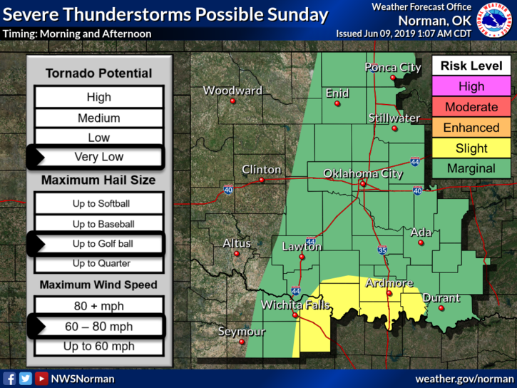
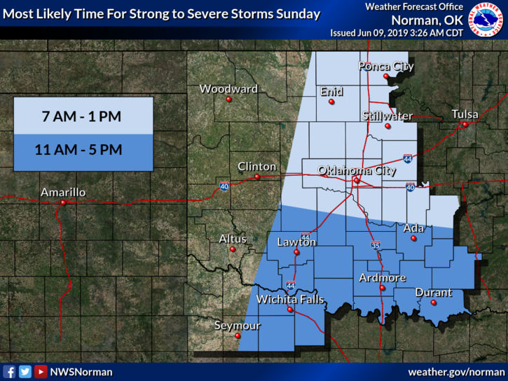
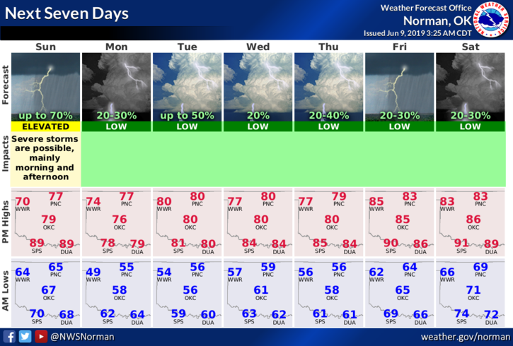
1- MARGINAL RISK for severe weather today. ”If” storms occur, winds and hail will be the bigger threats along with torrential rainfall. The tornado risk is very low.
2- A COLD FRONT will pass through the area this afternoon bringing much colder temperatures. With the winds increasing after frontal passage, you may need a light jacket.
3- Be sure and download our GARFIELD COUNTY EM app. You better prepared with it than without it.
4- Here is your forecast from the NWS/NORMAN;
Today- Mostly cloudy and not as warm. Thunderstorms likely in the morning & this afternoon. Highs in the mid-70s. Southeast winds 10 to 15 mph shifting to the north 15 to 25 mph in the afternoon. Chance of thunderstorms 70 percent.
Tonight-Partly cloudy and Cooler. Lows in the lower 50s. North winds 15 to 25 mph decreasing to 10 to 15 mph after midnight.
HAVE A GREAT DAY!!
MIKE