0505L-SUNDAY OUTLOOK & INFO FROM GARFIELD COUNTY EMERGENCY MGMT-3/8/2020
1- RED FLAG WARNINGS HAVE ALL EXPIRED. With dewpoint temps forecast to be in the low 40’s and humidity in the 60s today, the FIRE DANGER is lower than yesterday. Continue to report any smoke or fire to 911.
2-Our TASK FORCE GROUP remains on stand-by for any fire assistance that may be needed around our area. We don’t self-deploy but we are in constant contact with other Emergency Management officials in several counties.
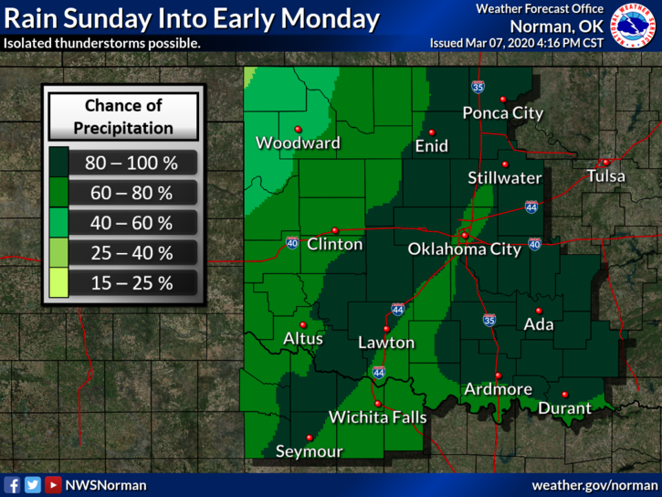
3- Weatherwise, moisture is a key factor today as a storm system may bring us rainfall as early as this afternoon. Timing is difficult to pin down but later this afternoon looks pretty good. We’ll see what happens.
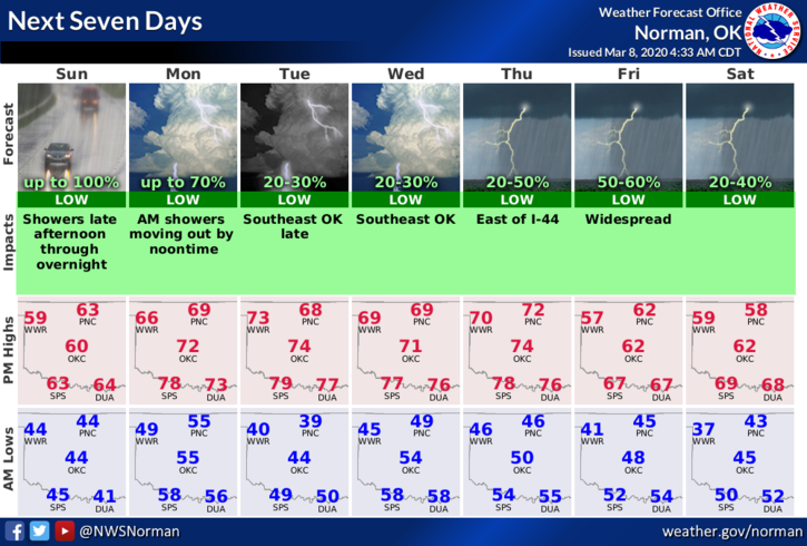
4- Here is your forecast from the NWS/NORMAN;
Today-50 percent chance of showers after 4pm. Increasing clouds with a high near 62. Windy with a south wind 17 to 25 mph with gusts as high as 36 mph. New precipitation amounts of less than a tenth of an inch possible.
Tonight-Showers mainly before 4am. Low around 54. South wind 18 to 20 mph, with gusts as high as 28 mph. Chance of precipitation is 80%. New precipitation amounts between a tenth and quarter of an inch possible.
HAVE A GOOD DAY!!
MIKE