0315L-SUNDAY OUTLOOK FROM GARFIELD COUNTY EMERGENCY MANAGEMENT-5/15/22
1- Here is your forecast from the NWS/NORMAN;
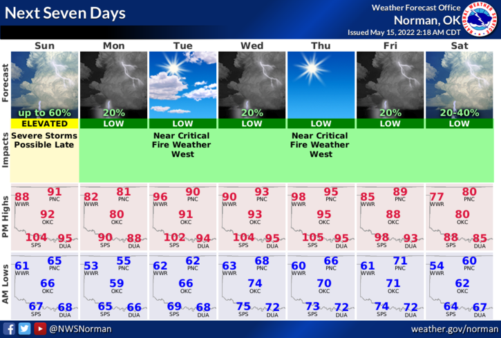
Today-Sunny. Highs: lower 90s. SE winds 5 to 10 mph, becoming north 10 to 15 this afternoon.
Tonight-Mostly clear. Lows in the mid-50s. North winds 10 to 15 mph with gusts up to 25 mph.
2- We are in a Marginal Risk for severe weather later this afternoon into this evening. See first graphic attached. The higher threat will be east of I-35, for the most part. We are expecting a cold front through the area but the cooler air will lag behind so we’ll feel that effect on Monday.
3- There was some severe weather in the county overnight mainly in the northeastern quadrant but we did see a lightning show along with the thunder effect. Rainfall amounts around 1 inch were indicated on radar. Again, for today expect muggy conditions and possibly some severe weather depending on where this all sets up. We’ll see what happens.
Be sure to download our GARFIELD COUNTY EM app. You’re not prepared without it!
HAVE A GOOD DAY!!