0410L-SUNDAY UPDATE AND OUTLOOK FROM ENID/GARFIELD COUNTY EMERGENCY MANAGEMENT-5/20/18
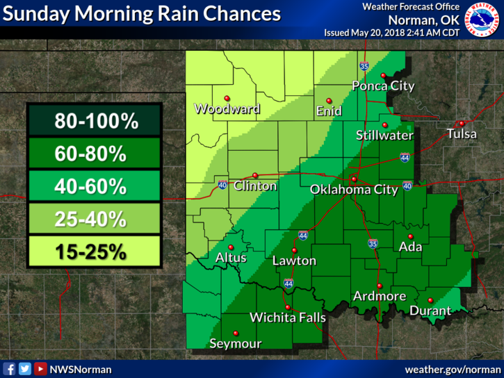
1-STRONG BUT “NOT SEVERE” STORMS WILL AFFECT THE AREA FOR AWHILE THIS MORNING. GUSTY WINDS, LIGHTNING AND THUNDER AND HEAVY RAIN AT TIMES CAN BE EXPECTED. MOVEMENT ON SOME THESE CELLS IS VERY SLOW SO LOCALIZED FLOODING COULD OCCUR.
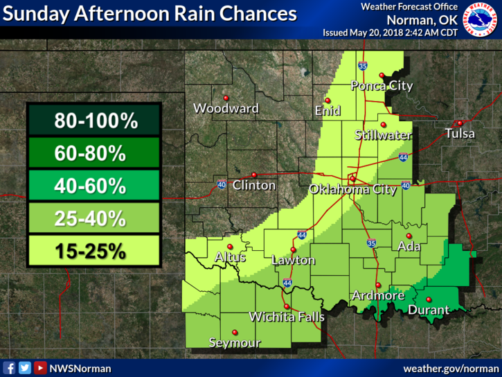
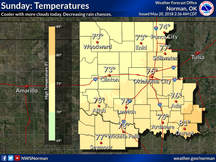
2- We are dealing with a slow moving cold front and thus the storms. As the front moves to the southeast, our storm chances will diminish and by this afternoon, we should see some clearing skies and high temps in the mid 70’s.
3-Overall, we’ll be ok and the weather will calm down. This said, make sure you have downloaded our GARFIELD COUNTY EM app which is your first line of preparedness. NWS WARNINGS AUTOMATICALLY COME THROUGH AND YOU’LL GET “LOCAL” INFORMATION DIRECTLY FROM THIS OFFICE.
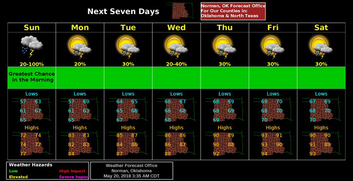
4- Here is your forecast from the NWS/NORMAN;
Sunday-30 percent chance of showers and thunderstorms, mainly before 7am. Cloudy, then gradually becoming mostly sunny, with a high near 75. North northwest wind 5 to 10 mph.
Sunday Night-20 percent chance of showers and thunderstorms. Partly cloudy, with a low around 59. East northeast wind 3 to 6 mph.
HAVE A SUPER DAY AND WE’LL KEEP AN EYE TO THE SKY, JUST IN CASE.
MIKE