0350L-SUNDAY OUTLOOK FROM GARFIELD COUNTY EMERGENCY MANAGEMENT-5/30/21
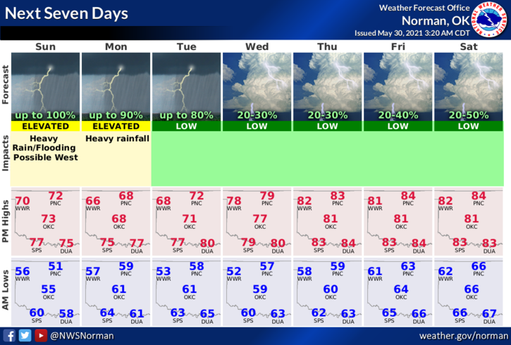
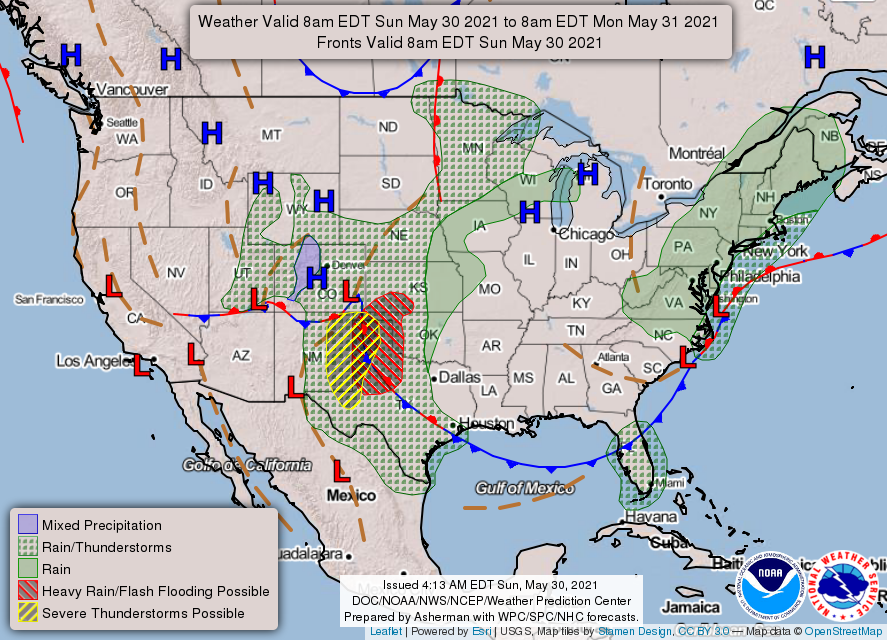
1- We’re, once again, in a GENERAL THUNDERSTORM risk area for today and Monday. All this means is enjoy the weather and it might rain. The storms in the TEXAS Panhandle don’t look like they will hold together in affect us today. Per guidance, we look to remain dry today until this evening and overnight tonight when we have a better chance for showers and possibly a few thunderstorms. We’ll just have to wait and see what happens.
2-We will remain cool with light southeasterly winds during the day so get outside, enjoy the cooler weather while you can. True late spring and early summer conditions will return soon and we’ll wish it were cooler. Overall, we’ll be ok so here is your forecast from the NWS/NORMAN;
Today-Mostly cloudy. A slight chance of rain showers and isolated thunderstorms late in the morning. A chance of rain showers and isolated thunderstorms in the afternoon. Highs in the mid-70s. Southeast winds around 10 mph. Chance of precipitation 50 percent.
Tonight-Mostly cloudy with a chance of thunderstorms. Lows in the upper 50s. Southeast winds around 10 mph. Chance of thunderstorms 50 percent.
Be sure to download our GARFIELD COUNTY EM app. It’s a great tool for info and it just might save your life!
HAVE A GOOD DAY
MIKE