SUNDAY OUTLOOK FROM GARFIELD COUNTY EMERGENCY MANAGEMENT-5/5/19
GARFIELD COUNTY EM = PREPAREDNESS. IT’S YOUR CHOICE.
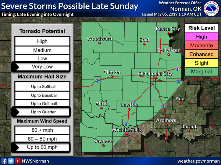
1- We are in a MARGINAL RISK for severe weather later today and tonight. If storms occur, quarter size hail and winds around 60 mph are possible. The tornado threat is very low.
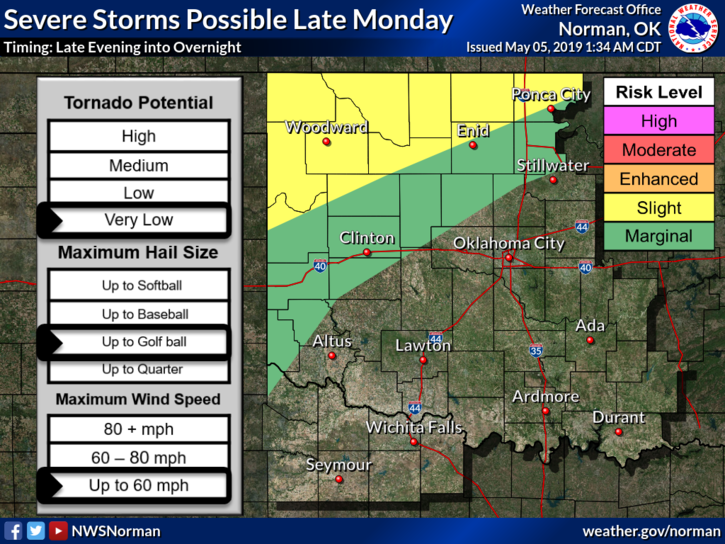
2- That said we have a risk through Wednesday for varying degrees of severe weather so stay weather aware. Some of this may change as we move forward so be prepared either way.
3- Overall, no need to panic. Storms have occurred for millions of years and we can’t stop them. Learn more about them so you can understand what’s happening. Hopefully your level of fear will lessen some. Download our GARFIELD COUNTY EM app and you’ll know what’s going on.
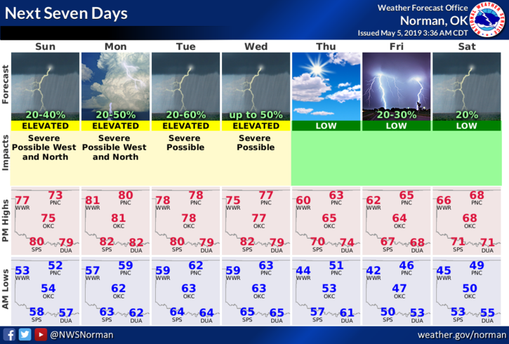
4- Here is your forecast from the NWS/NORMAN;
Sunday- Mostly cloudy. 30% chance for thunderstorms during the day. Highs in the mid-70s with south winds 10 to 15 mph.
Sunday Night-Partly cloudy. 30% chance for thunderstorms this evening and overnight. Low temps near 60. South winds around 10 mph.
HAVE A SUPER DAY AND I’LL ADVISE IF NEEDED.
MIKE