0455L-MONDAY OUTLOOK FROM GARFIELD COUNTY EMERGENCY MANAGEMENT-5/6/19
GARFIELD COUNTY EM = PREPAREDNESS. IT’S YOUR CHOICE.
1- We did have a few severe storms last night and rainfall amounts will definitely be different around the area. I had ½ inch. What about you all? Let me know.
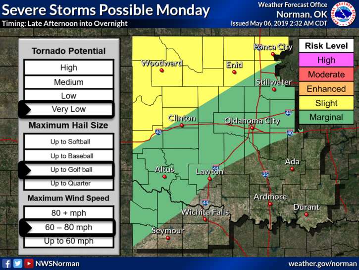
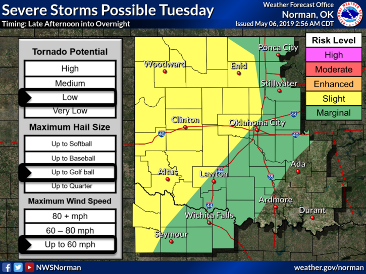
2- We are expecting another round of severe weather later today into tonight. Timing is a little sketchy. See graphics attached and keep in mind that these lines on the graphics will change several times. Large hail and damaging wind will be the main threats.
3- Overall, we should be ok. As new data comes in and if things do change, I’ll advise over our app.
4- Not too sure where all the flood and tornado warnings are coming from for some of you but some had received warnings and those warnings weren’t happening near them. Double check your subscriptions to other apps and entities so you don’t need to panic needlessly.
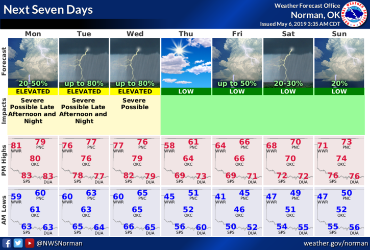
5- Here is your forecast from the NWS/NORMAN;
Monday-A slight chance of showers and thunderstorms during the day. Cloudy then gradually becoming mostly sunny, with a high near 79. South wind 5 to 54 mph, with gusts as high as 20 mph. Chance of precipitation is 20%.
Monday Night-40 percent chance of showers and thunderstorms. Mostly cloudy with a low around 62. South wind 5 to 10 mph.
HAVE A GOOD DAY!!
MIKE