0345L-SUNDAY OUTLOOK FROM GARFIELD COUNTY EMERGENCY MANAGEMENT-10/4/2020
1-GARFIELD COUNTY EM is our notification app. If you don’t have it, you will need it and you’re NOT PREPARED without it in Garfield County. Don’t wait until the last minute to prepare! Many folks state that it will never here. It has in the past and it will happen again. Make every effort to stay informed so you’ll know what to do when IT happens.
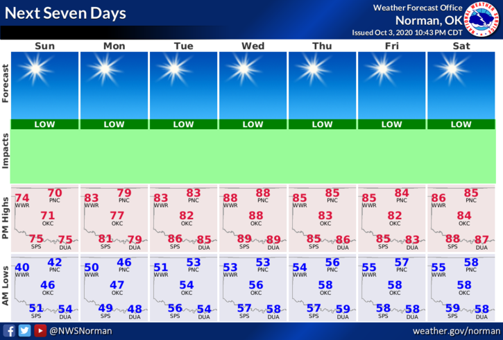
2- Today will be cool but with sun. It appears we will have a very warm to hot week with no real chance for rainfall. Mid-week will be the warmest with highs back to near 90 degrees. Highs will average from the mid-80s up and lows will average in the low to mid-50s, give or take.
3-Overall we’ll be ok so enjoy the week and take the opportunity to soak in some sun. Here is your forecast from the NWS/NORMAN;
Sunday- Sunny. Highs in the lower 70s. East winds around 10 mph.
Sunday Night- Clear. Lows in the mid-40s. Southeast winds around 10 mph.
Finally, we are starting to really dry out and we are in the ABNORMALLY DRY zone per the Drought Monitor. Be careful utilizing anything related to fire and call 911 if you see smoke or fire.
HAVE A GOOD DAY!!
MIKE