0400L-THURSDAY OUTLOOK FROM GARFIELD COUNTY EMERGENCY MANAGEMENT-4/22/21
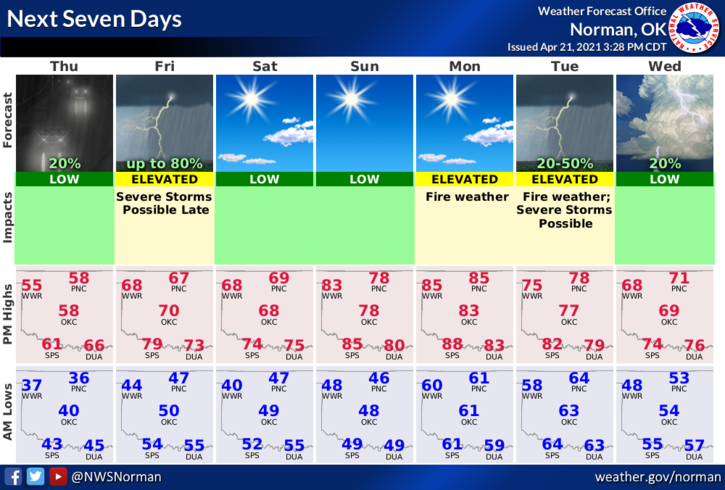
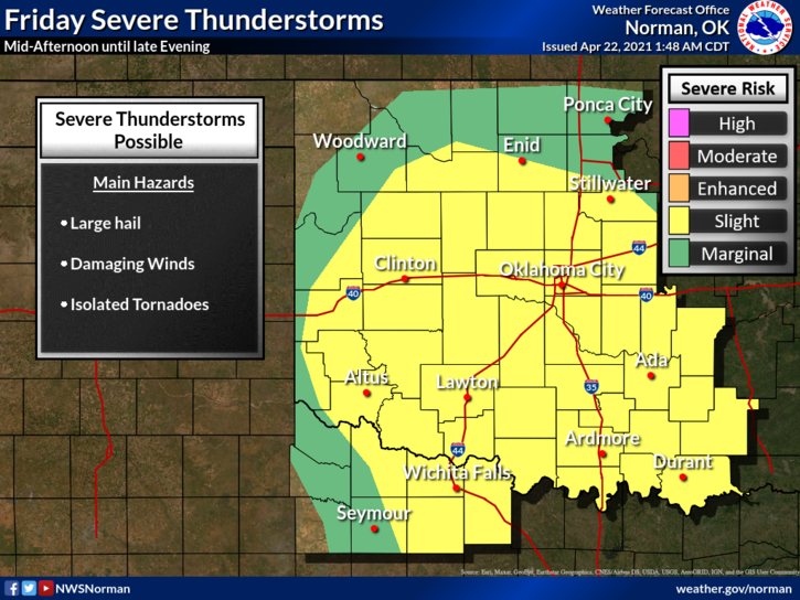
1- Clear early then becoming partly to mostly cloudy by mid afternoon or so. We’ll have a chance for some shower activity later today and overnight. Winds may be a bit gusty at times but overall, not too bad. Another front will push through the area along with a dryline and a chance for severe weather on Friday. Any storms we see today or tonight should not be severe.
2- The front I mentioned in the above paragraph should impact our area sometime late afternoon into the early evening hours. Timing with the dryline/front/ and the main storm system is crucial which will dictate any severe weather we may have. We’ll see what happens.
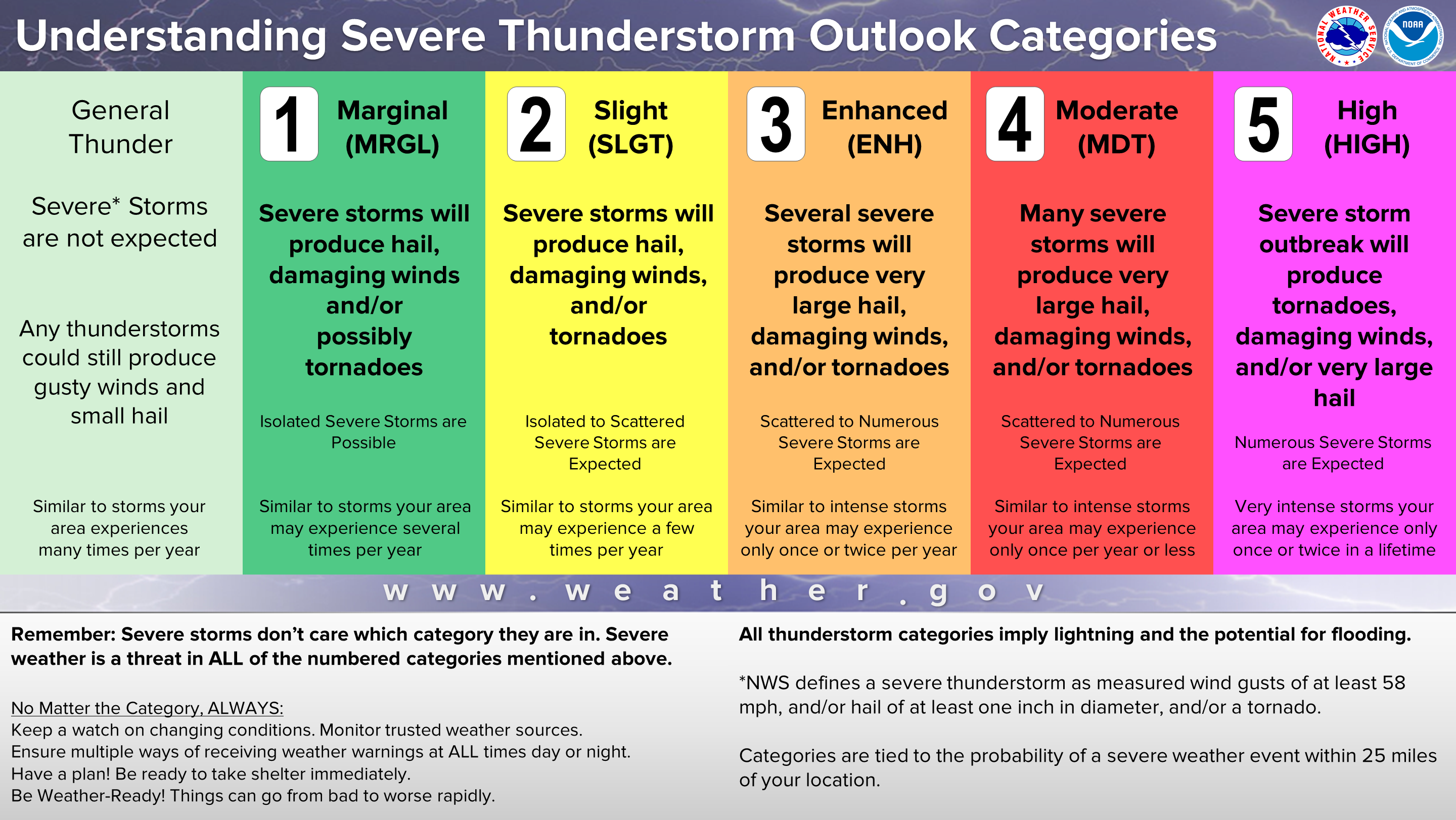
3-FROM NOW ON FOR OUR AREA, when we talk about severe weather, keep these parameters in mind; 1 inch hail, winds in excess of 58 mph, and isolated tornadic activity. These three items are what depicts the definition of severe weather. You may also see torrential rainfall, intense lightning, and there could be flooding. I will add a graphic that will explain the thunderstorm categories for you.
4- Here is your forecast from the NWS/NORMAN;
Today-Mostly cloudy. A slight chance of rain showers in the afternoon. Highs in the upper 50s. Southeast winds 10 to 15 mph. Chance of showers 20 percent.
Tonight-Mostly cloudy. Areas of drizzle and a slight chance of thunderstorms after midnight. Lows in the mid-40s. South winds 10 to 15 mph. Chance of thunderstorms 20 percent.
HAVE A GOOD DAY!!
MIKE