5:35pm-THURSDAY EVENING ADVISORY FROM ENID/GARFIELD COUNTY EMERGENCY MANAGEMENT
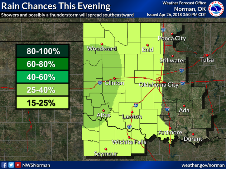
1-SHOWERS ARE EXPECTED THIS EVENING ANYTIME AFTER 7PM UNTIL 1 TO 2 AM. They may or may not occur here but that possibility does exist. No severe storms tonight but it can rain all it wants too.
2- The Governors BURN BAN has been LIFTED for Garfield County and several others. The following link is safe. http://www.forestry.ok.gov/burn-ban-info
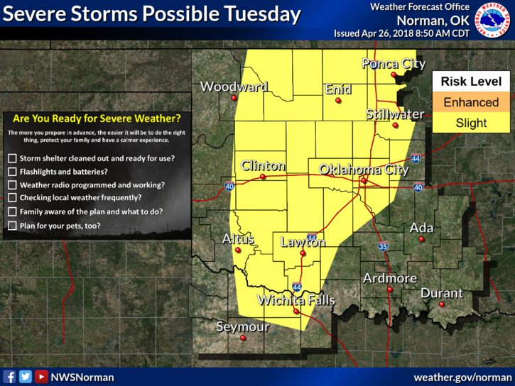
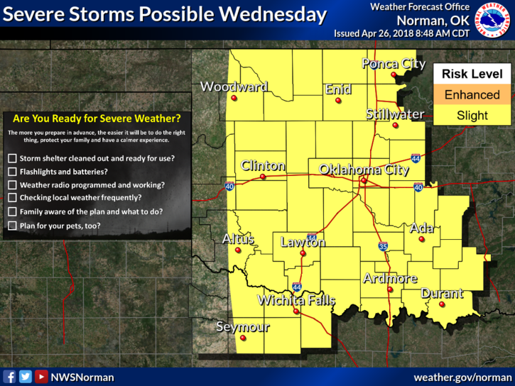
3- As stated this morning, Tuesday and Wednesday may be severe weather days. Mesoscale features are not set in stone as of yet so don’t get too stressed about this right now. We will have instability in the atmosphere along with moisture but we’ll also be dealing with a capping inversion too. The cap usually helps to suppress storms. A lot can happen between now and then so hang in there and we’ll keep up with all the information from the STORM PREDICTION CENTER. The storm system everyone is hyped up about is 5 DAYS AWAY and hasn’t formed yet. We’ll see what happens.
4-Download our GARFIELD COUNTY EM app and we’ll keep you up to date. By the way, ALL NWS WARNINGS automatically come through our app. I will send out advisories as data verifies so rest assured you will get good panic free information. The most important thing here is this: ARE YOU PREPARED FOR STORM SEASON? If not, go to the following link and download our Preparedness Guide from our gcem.org website. It’s loaded with good information. Here is that link: https://gcem.org/wp-content/uploads/2017/08/Garfield-County-Family-Preparedness-Guide-2017.pdf
5- I will be tied up instructing 2 spotter classes for our countywide spotter network this evening so if it does rain, just enjoy it. If it doesn’t rain, then get out and get some fresh air and enjoy that.
For now, HAVE A SUPER EVENING!!
MIKE