0350L-THURSDAY OUTLOOK & INFO FROM GARFIELD CO. EMERGENCY MGMT-8/15/19
GARFIELD COUNTY EM. This app is loaded with very good info and you can store a lot of information within it. It will warn you when bad things happen. There is no need to be without it so download it and know the NWS & GCEM will keep you advised.
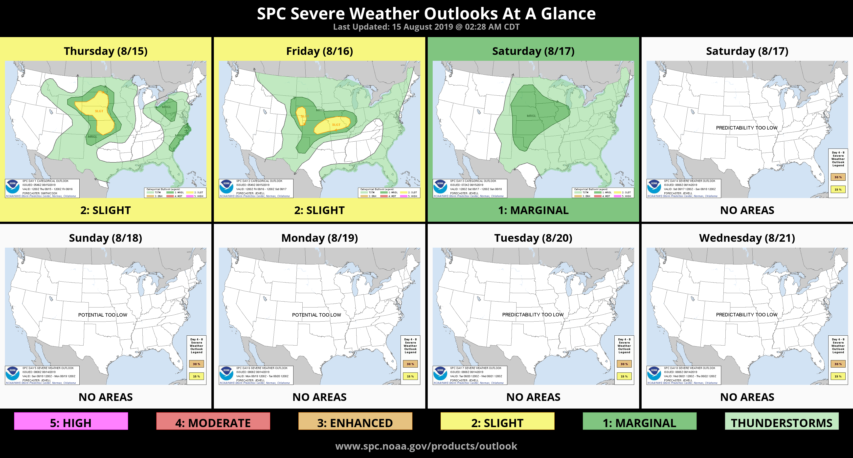
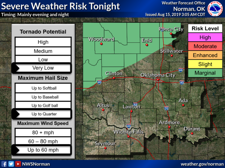
1- MARGINAL RISK for severe weather later this evening and overnight. IF storms occur, wind and hail will be the main threats. This risk remains through Friday also. See graphics.
2- We continue to stay under northwest flow so expect thunderstorms later in the days and overnight hours through early next week. Nothing is guaranteed but we’ll see what happens.
3-HEAT-WISE continue to be careful while working outdoors and stay hydrated. If not, a trip to the E.R. may be in order!!!
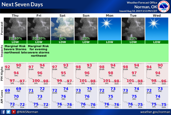
4- Here is your forecast from the NWS/NORMAN;
Thursday- Sunny with a high near 95. Heat index values as high as 98. South wind 5 to 15 mph.
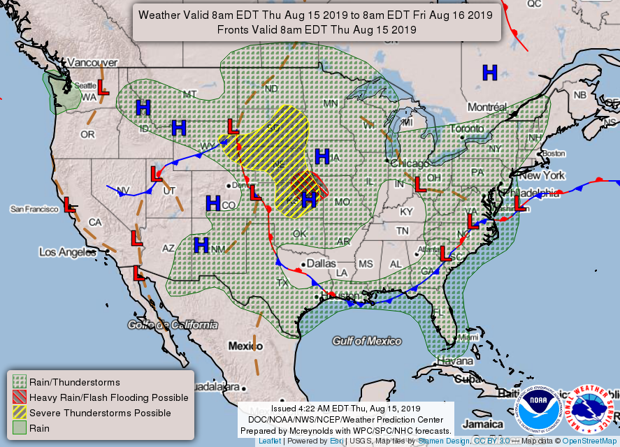
Thursday Night-40% chance of showers and thunderstorms. Increasing clouds with a low around 72. South wind around 10 mph.
HAVE A GREAT DAY!!
MIKE