FROM GARFIELD COUNTY EMERGENCY MANAGEMENT-WEDNESDAY 8/16/17
DON’T FORGET!! DOWNLOAD OUR EMERGENCY APP GARFIELD COUNTY EM. IT JUST MIGHT SAVE YOUR LIFE.
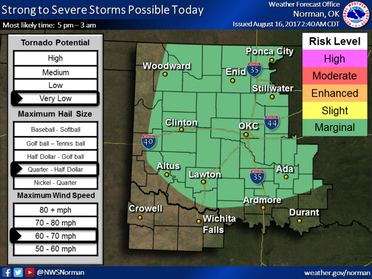
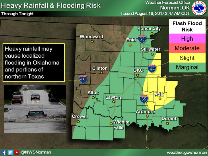
It’s going to rain again today and some storms “MIGHT” be severe. The severe threats should be hail, mostly the winds, and of course torrential rainfall. As I stated yesterday, watch out for low lying areas but also keep an eye out for water over the road where you normally drive. In that case SLOW DOWN. Hydroplaning looks fun but you are OUT OF CONTROL, especially if you are going fast and other vehicles are around you. Your heart will beat faster and you suddenly feel dread. Hmm, it appears that I may have experienced this before! YEP. Just slow down.
Here is your forecast from the NWS/NORMAN;
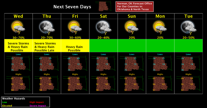
Wednesday-50 percent chance of showers and thunderstorms, mainly after 1pm. Partly sunny, with a high near 91. Heat index values as high as 100. South southwest wind 8 to 14 mph, with gusts as high as 20 mph. New rainfall amounts between a tenth and quarter of an inch, except higher amounts possible in thunderstorms.
Wednesday Night-50 percent chance of showers and thunderstorms. Mostly cloudy, with a low around 69. West southwest wind 5 to 10 mph becoming north northwest after midnight. New rainfall amounts between a quarter and half of an inch possible.
HAVE A SUPER DAY!!
MIKE