0355L-THURSDAY OUTLOOK FROM GARFIELD COUNTY EMERGENCY MANAGEMENT-8/20/2020
1-Rain out west and cooler than average temps here in the area will continue. Highs in the upper 80s are better than the mid-90s so enjoy this while you can. It could always be worse. Even though we are cooler than what is known as average temps, you still need to be careful out there. Make sure you hydrate before and during strenuous activities. It doesn’t have to be 105 to have heat issues.
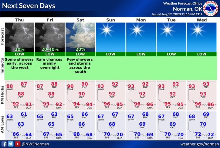
2- There will be chances over the next few days for some scattered thundershowers so if they occur, gusty winds and heavy rainfall will be the threats along with lightning. Some of the lightning has been pretty vicious this year.
3- Overall, we’ll be ok mainly dealing with some heat issues so here is your forecast from the NWS/NORMAN;
Thursday-Sunny with a high near 87. Southeast wind 5 to 10 mph.
Thursday Night-Mostly clear with a low around 65. Southeast wind around 10 mph.
DIRECTORS COMMENT
Many folks have emailed me complaining about not seeing any Covid 19 updates on our GARFIELD COUNTY EM app. The health department has been doing that for me. As most are aware, they are busy! You can always go to the state health department website and look up numbers for yourselves too. Here is that link- https://coronavirus.health.ok.gov/
I am a one man operation in emergency management 98% of the time and there are many things going on in the background that you all never see. Please be patient as we try to get folks to help us out.
HAVE A SUPER DAY!!
MIKE