0335L-THURSDAY OUTLOOK FROM GARFIELD COUNTY EMERGENCY MANAGEMENT-8/26/21
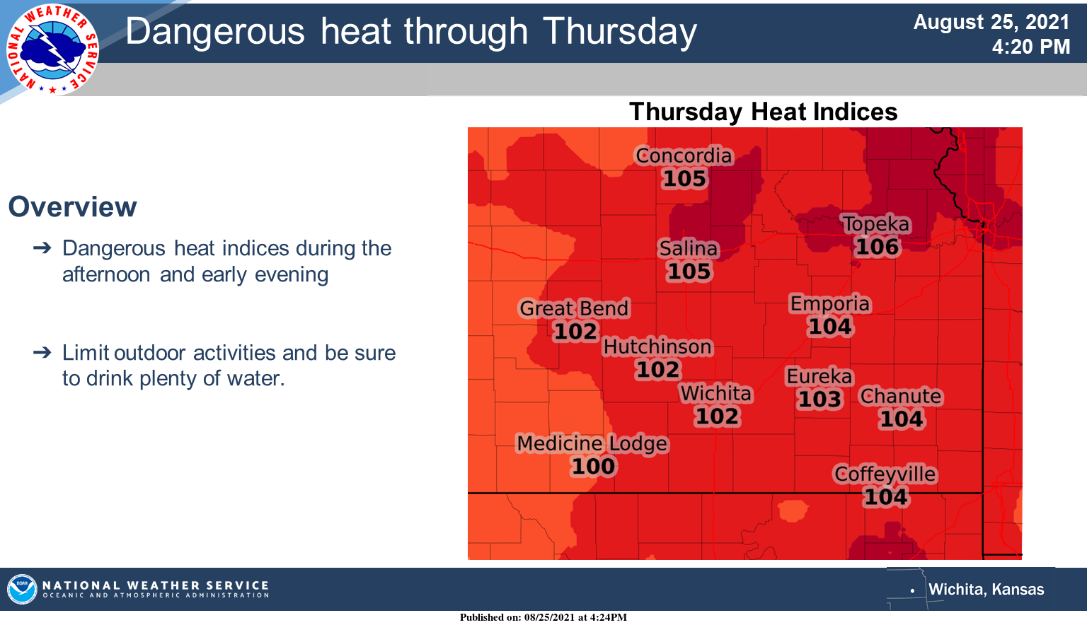
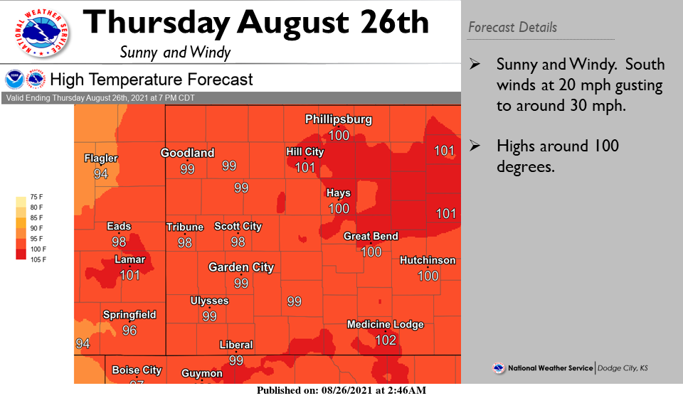
1- HOT and DRY is on the menu along with the winds though slightly less than previous days. The main issues are the heat and slowly increasing fire danger. Even though most grassland areas are fairly green, they are dry and can catch fire fairly easily. We are asking that ANYONE that works with anything related to fire, use extreme caution. All it takes is a spark and then we have a problem.
2- Continue to take those heat precautions and keep an eye on each other while working outdoors. Know the signs of heat exhaustion and take action if needed. On the weather side of things, rain chances this weekend are looking less and less but as always, this could change so we’ll watch and see what may happen and we’ll deal with it accordingly. With a tropical storm brewing in the Caribbean Sea right now, we’ll see how this might affect the area if at all.
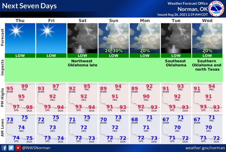
3- Overall, we’ll be ok so here is your forecast from the NWS/NORMAN;
Today-Sunny & hot with highs near 98. Heat index values around 101. South wind 5 to 15 mph.
Tonight-Mostly clear. Lows in the low70s. South southeast wind 10 to 15 mph.
FINALLY: be sure to download our GARFIELD COUNTY EM app. Besides all the info packed into it, it just could save your life.
HAVE A GOOD DAY!
MIKE