FROM GARFIELD COUNTY EMERGENCY MANAGEMENT-THURSDAY 8/3/17
Chances for rain are on the increase as we venture into the weekend and next week. Where exactly will the rain fall, don’t have that answer but hopefully we’ll see some more later today and then over the weekend. There may be some severe weather involved so if that occurs, the main threats look to be the wind and possibly hail. We’ll wait and see how this mess comes together and deal with it accordingly.
There is no reason to worry or panic over anything at this point. I would just enjoy the cooler weather. Now is a good time to download our GARFIELD COUNTY EM app at your app store and learn how it works. It’s free and you’ll get information concerning the weather and any large scale incidents. There is a lot of great info on it as well.
Our website has been updated and we are still tweaking it as I type this morning. We also updated our PREPAREDNESS GUIDES. You can actually save or download a copy of it from this address: https://gcem.org/docs/ the first few pages are how our app works. Let me know what you think.
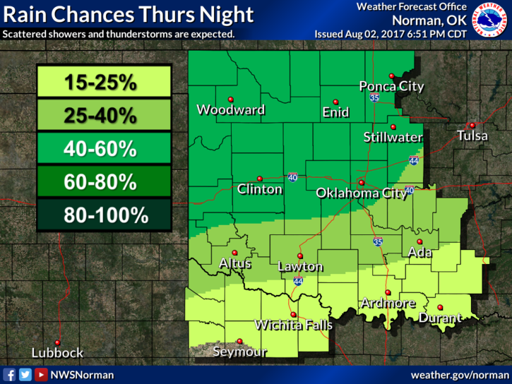
Here is your forecast from the NWS/NORMAN;
Thursday-30 percent chance of showers and thunderstorms after 1pm. Mostly sunny, with a high near 92. South southwest wind 3 to 6 mph.Thursday Night-40 percent chance of showers and thunderstorms. Mostly cloudy, with a low around 66. East wind 6 to 9 mph becoming north in the evening.
HAVE A GREAT DAY!!
MIKE