0335L-THURSDAY OUTLOOK FROM GARFIELD COUNTY EMERGENCY MANAGEMENT-12/16/21
1-The wind did blow along with the dust, smoke, and whatever else was in the air. Our highest “recorded” wind speed was 58 mph at the Lahoma Mesonet sight and at the Vance Air Force Base “AWOS” station. That stands for automated weather observing system. I really believe we had higher gusts around the area so if you have an anemometer that records info, please send it to me. Thanks, in advance.
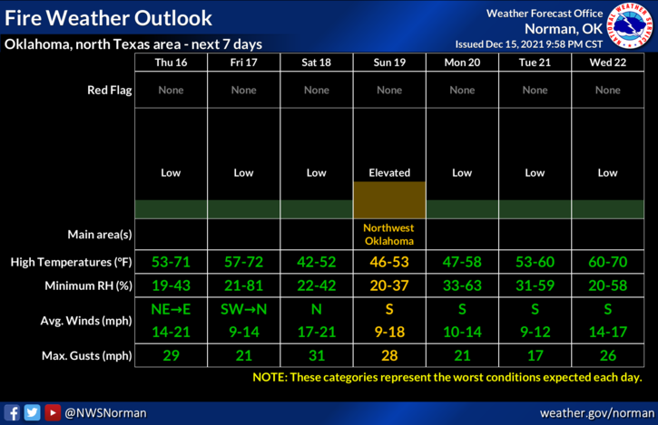
2- There were several areas where there was tree damage, signs blown over, and other issues but overall, we did ok. A few fires did occur in Enid and out in the county but response was quick and nothing got out of control. We will remain dry and the Fire danger will remain so continue to report smoke and fire to 911.
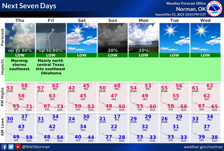
3- Weather-wise- cooler and a lot less windy today. Here is your forecast from the NWS/NORMAN;
Today-Sunny. Much cooler. Highs in the mid-50s. Northeast winds around 10 mph.
Tonight-Partly cloudy. Lows in the lower 30s. Light and variable winds.
HAVE A GOOD DAY!