0320L-WEDNESDAY OUTLOOK FROM GARFIELD COUNTY EMERGENCY MANAGEMENT-12/15/21
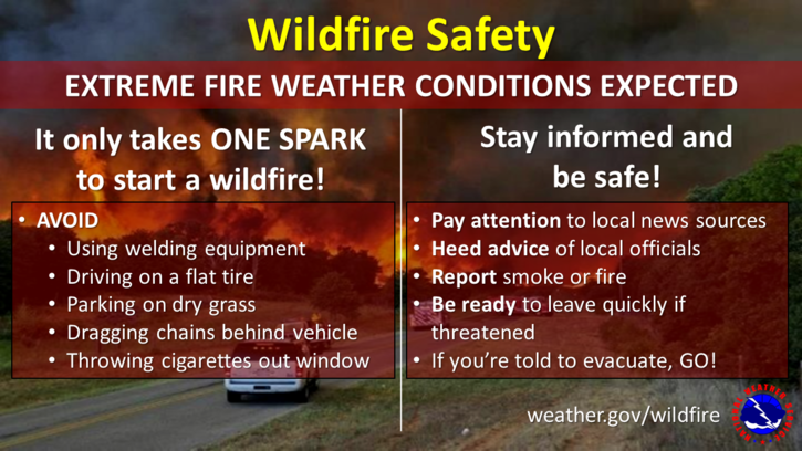
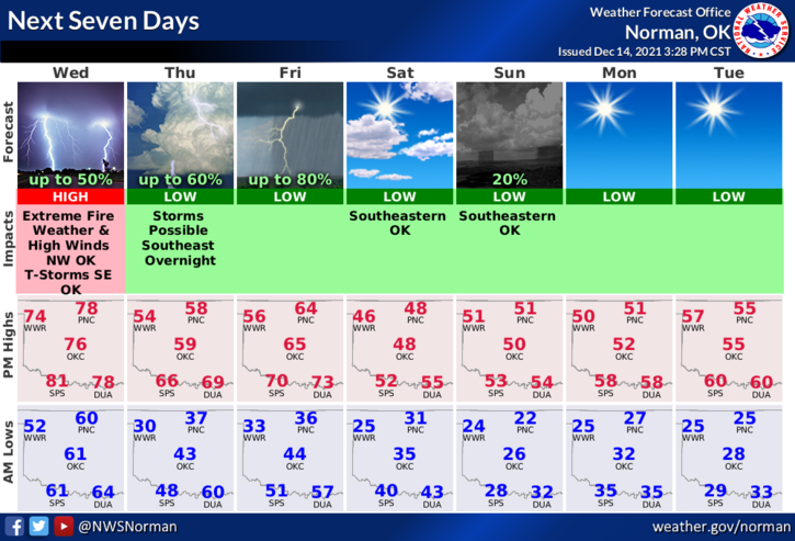
1-RED FLAG WARNING to our west, WIND ADVISORY here, and a MARGINAL RISK for severe weather to our east. Looks like a typical day in Oklahoma. The main issue here will be the wind. We are expecting wind GUSTS upwards of 60 mph at times so if you plan on being outside, be prepared for dirt and whatever else that may be flying around. East/west travel may be a bit touchy so use caution while driving. It wouldn’t surprise me to see a few wind warnings even in our area as the day progresses.
2- The FIRE DANGER is way up there right now so if you happen to see smoke and or fire anywhere out there, call 911 so the proper response can be sent.
3- All of this mess is due to a surface low in southeastern Colorado which will be moving across Kansas. As it moves out, a cold front will push into the area shifting winds from the SSW to the NNW later this afternoon into the evening hours. Light winds are expected on Thursday.
4- Here is your forecast from the NWS/NORMAN;
Today-Patchy blowing dust after 1pm. Mostly cloudy, then gradually becoming sunny, with a high near 77. Windy, with a south wind 20 to 25 mph increasing to 32 to 37 mph in the afternoon. Winds could gust as high as 60 mph.
Tonight-Patchy blowing dust before 8pm. Mostly clear, with a low around 35. West southwest wind 17 to 22 mph becoming west 5 to 10 mph in the evening. Winds could gust as high as 33 mph.
FINALLY, Download our GARFIELD COUNTY EM app and stay up with the latest info from us and the NWS.
HAVE A GOOD DAY.