0325L-THURSDAY OUTLOOK FROM GARFIELD COUNTY EMERGENCY MANAGEMENT-2/24/22
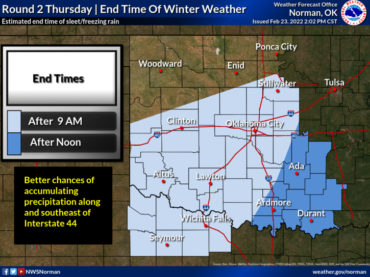
1-There are no advisories for Garfield County at this time. To our south, there is a WINTER WEATHER ADVISORY and a WINTER STORM WARNING in effect. The second wave of winter weather will be moving through the state this morning and be out of here by later this afternoon. We won’t be affected too much from this. We might see some snow, sleet, and possibly some freezing rain but amounts should be very light.
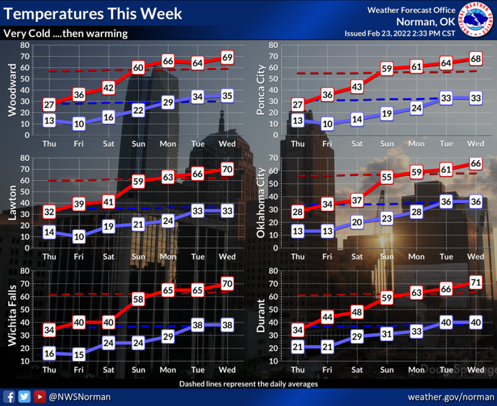
2- Roads should remain ok but if we are receiving any winter precipitation, roads could become a little slick here and there. Temperatures will remain in the low to mid 20s today and with lighter winds, the wind chill should remain just above zero. Either way, we’ll remain dangerously cold, so be careful and coverup out there.
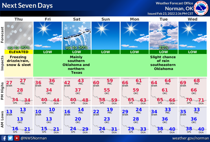
3- Here is your forecast from the NWS/NORMAN;
Today-Cloudy with a chance of snow showers with a slight chance of freezing rain this morning, then partly sunny this afternoon. Little or no snow accumulation. Cold with highs in the upper 20s. North winds 5 to 10 mph. Chance of precipitation 40 percent.
Tonight-Mostly clear. Cold with lows around 10 above. North winds 5 to 10 mph.
GRAPHICS are dated yesterday as the NWS hasn’t gotten these updated for today yet. They will be close.
STAY SAFE AND WARM!