0320L-WEDNESDAY OUTLOOK FROM GARFIELD COUNTY EMERGENCY MANAGEMENT-2/23/22
1-WIND CHILL ADVISORY from 0100 this morning until 1000 local time. As of now-0300, it’s 13 degrees with NE winds at 25 mph giving us a wind chill around -6 degrees. Ready for Spring?
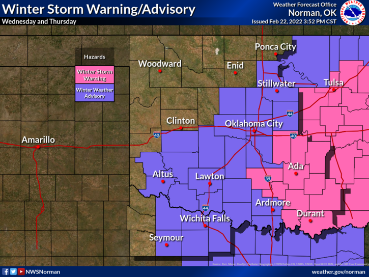
2- Everyone knows it’s cold so take the proper precautions and make sure you limit outdoor exposure. FROSTBITE is dangerous to everyone so cover up your skin. Per the graphics, we are on the northern side of where the storm system will track. We will see some sleet, snow, and possibly some freezing rain. If any of these occur and the roads may look ok but they may be slick and hazardous. Slow down and use extreme caution while driving.
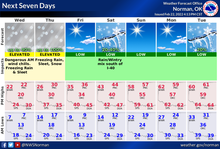
3- Overall, we’ll be ok so just use good common sense and we’ll get through this as we always do. Here is your forecast from the NWS/NORMAN;
Today-Cloudy. A chance of snow showers and sleet, mainly this morning. Little or no snow and sleet accumulation. Cold with highs in the lower 20s. North winds 15 to 20 mph. Chance of precipitation 50 percent. Wind chill values as low as 10 below this morning.
Tonight-Cloudy with a slight chance of freezing rain. A chance of snow with a slight chance of sleet after midnight. Little or no snow and sleet accumulation. Ice accumulation around a trace. Cold. Near steady temperature around 18. Northeast winds around 10 mph. Chance of precipitation 40 percent.
STAY WARM AND SAFE.