0325L-THURSDAY OUTLOOK & INFO FROM GARFIELD COUNTY EMERGENCY MGMT-2/27/2020
THE VANCE AFB WSR-88D WEATHER RADAR WILL BE DOWN THIS MORNING FOR MAINTENANCE. IT SHOULD BE BACK UP BY 1130 LOCAL TIME.
1- First, thank you to Medford Fire for hosting a storm spotter class that I instructed last night. Good crowd, good questions, and they are ready for spring. I will be doing additional classes around the Garfield County area starting the second week of March. I will announce dates as they are scheduled.
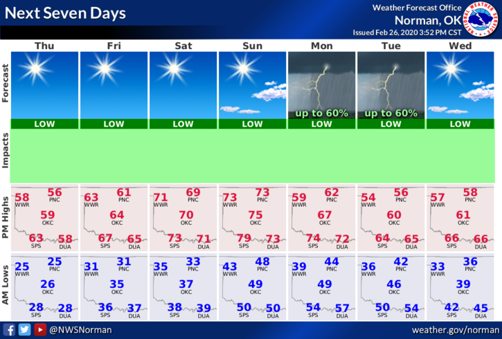
2-Weather-wise, southwest winds will become northwest winds this afternoon as another front pushes into the area. This front should come through dry. We will have a substantial warmup over the next 4-5 days until a storm system moves in next week to bring us back to reality. We’ll see what happens for sure next week. Until then, enjoy the warmer weather.
3- Here is your forecast from the NWS/NORMAN;
Thursday-High near 56 with south-southwest wind 10 to 15 mph becoming northwest in the afternoon. Winds could gust as high as 20 mph.
Thursday Night-Low around 32 with northwest winds 5 to 10 mph.
HAVE A GOOD DAY!!
MIKE