FROM GARFIELD COUNTY EMERGENCY MANAGEMENT
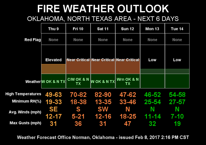
We will be starting a warming trend today into the weekend. As I have been stating for the last several weeks, the FIRE DANGER is very prominent at this time. It will be a bit worse over the weekend with low humidity and higher temps and winds so be EXTREMELY CAREFUL out there and report any fire or smoke ASAP to 911.
Several folks have asked about a storm spotter class. I posted an event a few weeks ago. It’s located on my E.M. PAGE on Facebook at the following link–@EGCEM
This class is free and OPEN TO THE PUBLIC. Click the link and you should find it.
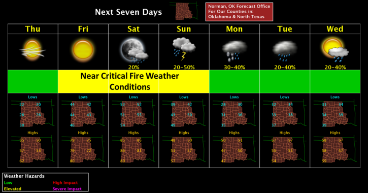
Here is your forecast from the NWS/NORMAN;
Thursday-Sunny, with a high near 51. East northeast wind 6 to 15 mph becoming south in the afternoon. Winds could gust as high as 21 mph.
Thursday Night-Mostly clear, with a low around 42. South wind 10 to 20 mph, with gusts as high as 28 mph.
Have a good day!!
MIKE