0400L-THURSDAY OUTLOOK FROM ENID/GARFIELD COUNTY EMERGENCY MANAGEMENT-1/3/19
1- AT 0350 LOCAL TIME, THERE IS A CHANCE FOR SOME LIGHT FREEZING RAIN/DRIZZLE IN THE AREA. THIS WILL PERSIST AS SUCH UNTIL WE RISE UP ABOVE FREEZING BY AROUND MID MORNING THEN PRECIP SHOULD TRANSITION TO LIQUID FORM IF IT’S STILL AROUND.
2- USE EXTREME CAUTION WHEN DRIVING EARLY THIS MORNING. High temps should be in the mid-40s by mid-afternoon then we’ll see where this mess ends up.
3- I will send out a GARFIELD COUNTY EM app update after our briefing with NWS officials later this morning. The update will come out around noon.
4-OVERALL, drive cautiously while we remain below freezing if surfaces appear wet. Overconfidence can get you in trouble real quick when you least expect it.
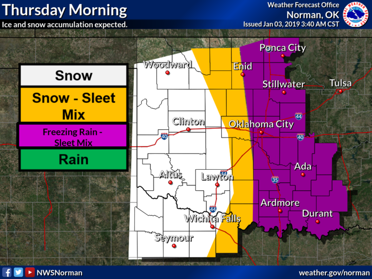
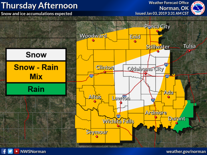
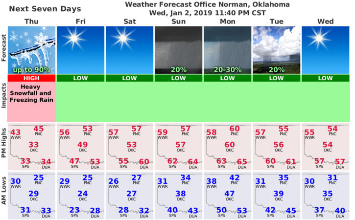
5- Here is your forecast from the NWS/NORMAN;
Thursday-Partly cloudy. A chance of rain, light freezing rain, snow and light sleet in the morning, then a chance of rain and snow in the afternoon. Highs in the mid 40s. Light and variable winds. Chance of precipitation 50 percent.
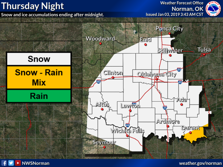
Thursday Night-Partly cloudy. A slight chance of snow in the evening. Lows in the mid 20s. Light and variable winds. Chance of snow 20 percent.
HAVE A GREAT DAY AND I’LL SEND OUT MORE INFO AS NEEDED.
MIKE