0340L-THURSDAY OUTLOOK FROM GARFIELD COUNTY EMERGENCY MANAGEMENT-7/1/21
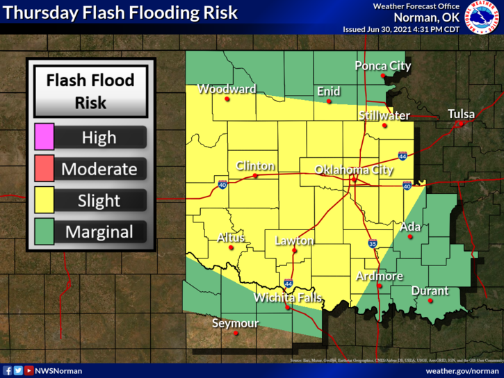
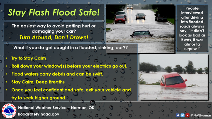
1- A FLOOD WATCH will continue through early Friday. A cold front will push through late this morning or early afternoon bringing us a chance for more rain and possibly some thunderstorms throughout the day and tonight. The ground is saturated in most areas so flooding is very possible. County roads are very muddy in most areas. If it looks bad, DON’T go down that road. While driving on any highway, watch for flooding and SLOW DOWN so you don’t hydroplane. If that occurs, you are no longer in control and you could end up in the ditch or worse, into another vehicle.
2- Here is your forecast from the NWS/NORMAN;
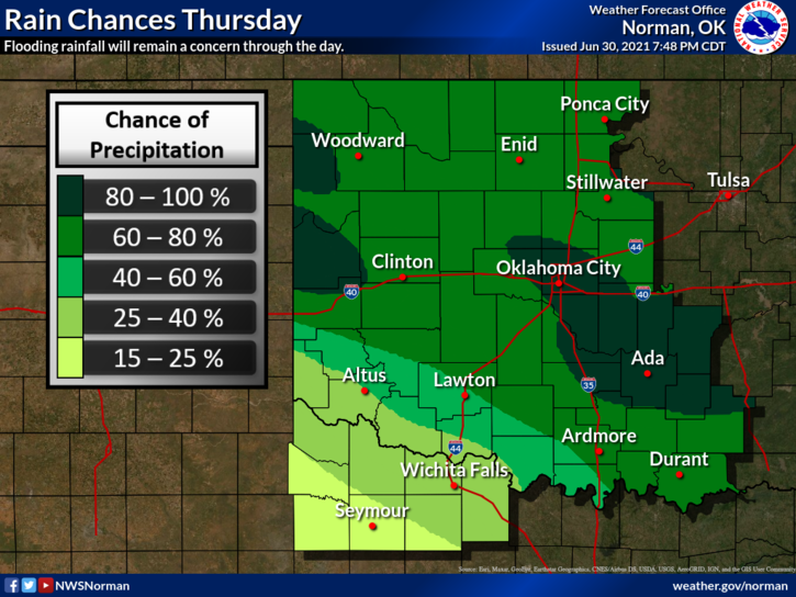
Today-Mostly cloudy. Thunderstorms likely until late afternoon, then a chance of thunderstorms late in the afternoon. Highs in the mid-80s. Light and variable winds becoming north around 10 mph in the afternoon. Chance of thunderstorms 70 percent.
Tonight-Mostly cloudy with a chance of thunderstorms. Lows in the upper 60s. Northeast winds up to 10 mph in the evening becoming light and variable. Chance of thunderstorms 50 percent.
NOTICE- With creeks and tributaries flowing with water, it flows faster than it looks. Keep children out of this water as snakes, turtles, and other critters are in there too. Getting bit would get you a trip to the emergency room. If the water is deeper, it could take a person downstream and a bad result could also occur. Just stay out of the water and everything will be ok.
Be sure and download our GARFIELD COUNTY EM app. It’s free to you and it just might save your life. Graphics weren’t updated at the time of this post but are very close to guidance.
HAVE A GOOD DAY!
MIKE