0340L-WEDNESDAY OUTLOOK FROM GARFIELD COUNTY EMERGENCY MANAGEMENT-6/30/21
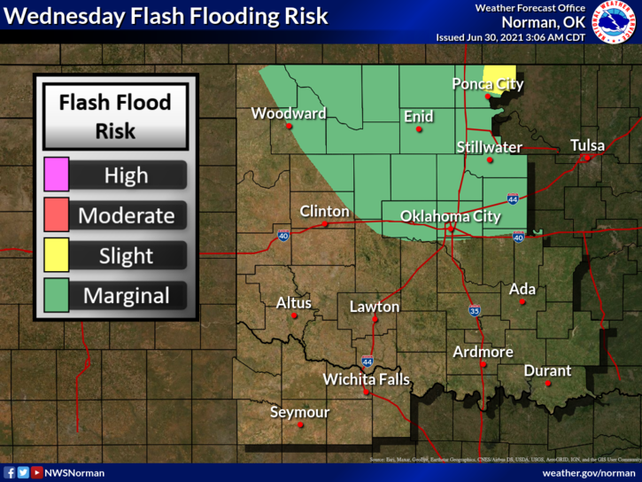
1- We are in a GENERAL THUNDERSTORM RISK area as we will continue to see heavy rainfall at times during the day and possibly again tonight. We had many reports of rainfall from 2 to 7 inches. I would like to remind everyone to please empty your gauges each morning so we get accurate numbers. I received 2.75 inches as of 8pm last night and looking at the gauge at 0255 this morning, I had 6 tenths of an inch for overnight rainfall. Either way, we have received a lot of water and more is forecast.
2- Because of the amount of rainfall, our streams and tributaries are filling up. Localized flooding will remain possible for the next few days. This said, keep the kids OUT OF THE WATER in these areas. I am seeing snakes in several areas and I got one out of the pool while outside looking at the rain gauge earlier. This happens several times during the summer anyways but higher water levels really brings them out. The water is flowing faster than it seems so that is also another hazard. If you have kids or grand-kids and a drainage area behind your house, keep an extra eye out for critters over the next several days.
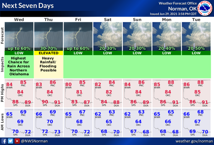
3- Overall, rain chances will remain and then the weekend looks to be at least partly sunny. Here is your forecast from the NWS/NORMAN;
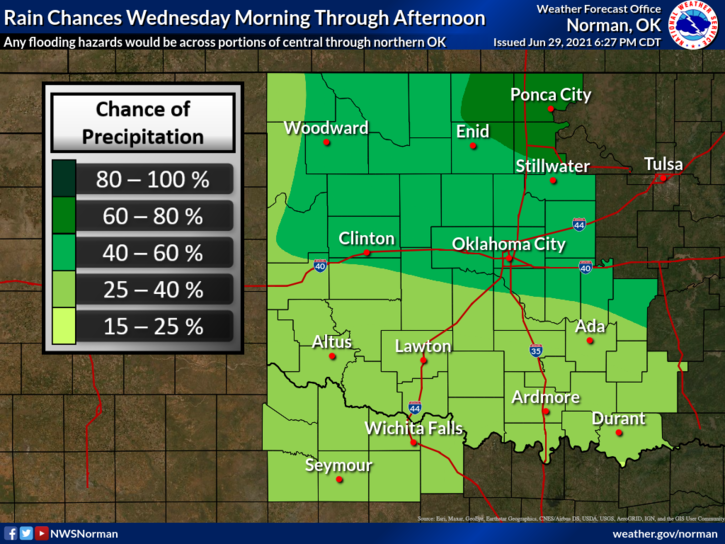
Today-Cloudy. A chance of showers and a slight chance of thunderstorms in the morning, then showers likely and a chance of thunderstorms in the afternoon. Highs in the mid-80s. Light and variable winds becoming southwest around 10 mph in the afternoon. Chance of precipitation 70 percent.
Tonight-Mostly cloudy. A chance of thunderstorms in the evening, then showers likely and a chance of thunderstorms after midnight. Lows in the upper 60s. Light and variable winds. Chance of precipitation 70 percent.
HAVE A GOOD DAY!
MIKE