0410L-THURSDAY OUTLOOK & INFO FROM GARFIELD COUNTY EMERGENCY MGMT-7/2/2020
VANCE RADAR IS DOWN AS IS THE WICHITA RADAR. Don’t worry, we can make due, without them in the event of severe weather. We’ve done it before.
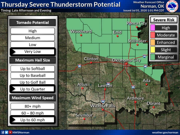
1-HEAT ADVISORY in effect until 8pm tonight along with a MARGINAL RISK for SEVERE WEATHER late this afternoon into the evening hours. If storms occur, hail, winds, lightning, & torrential rainfall will be the main threats.
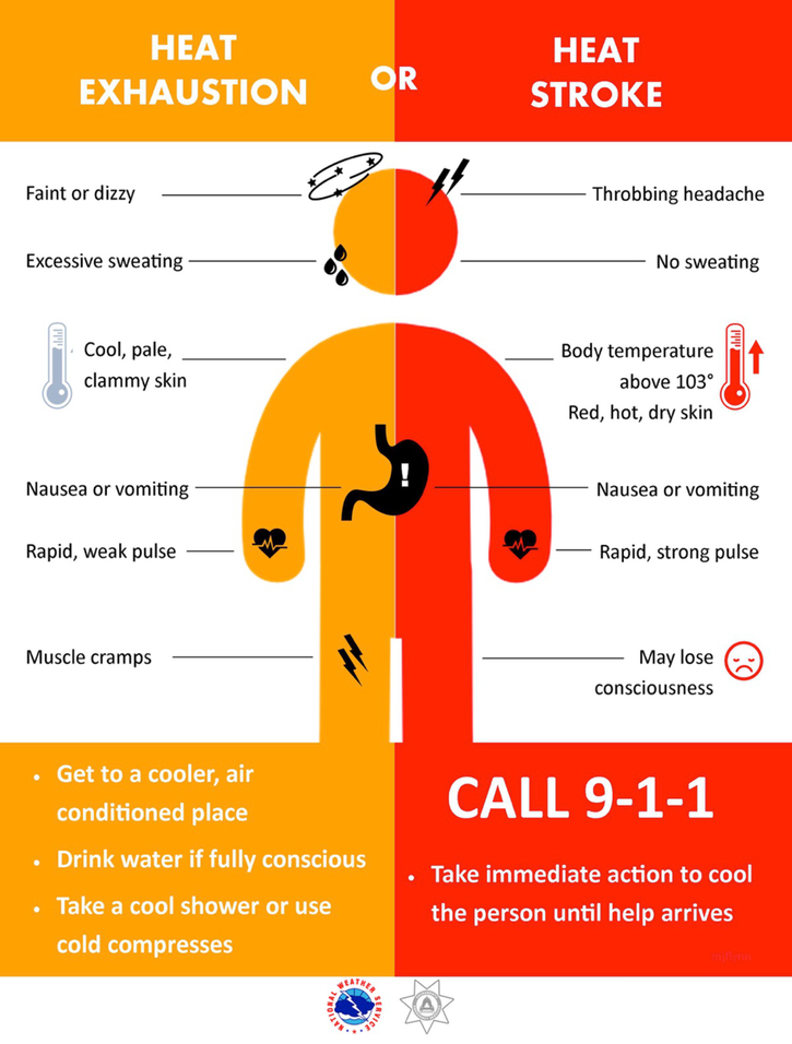
2- Heat related illness still has an effective hold on the area so be extremely careful if working outdoors once again today. There could be some relief per the storm chances but if they occur, it just could intensify the heat index a bit depending how much it rains in any particular area. Just be careful outdoors.
3- The FIRE DANGER still exists so report any smoke or fire to 911. Just be advised that many farmers are doing controlled burns and we ask that they call those in to dispatch. They should have a list of those who burn. If not, a response may be needed. Just stay vigilant keep an eye out for us. We thank you in advance.
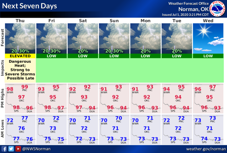
4- Here is your forecast from the NWS/NORMAN;
TODAY-20 percent chance of showers and thunderstorms after 4pm. Sunny and hot with a high near 100. Heat index values as high as 105. Southeast winds 5 to 10 mph.
Tonight-30 percent chance of showers and thunderstorms mainly between 7pm and 1am. Mostly cloudy with a low around 72. East wind 5 to 10 mph becoming calm after midnight.
HAVE A SUPER DAY!!
MIKE