0420L-WEDNESDAY OUTLOOK & INFO FROM GARFIELD COUNTY EMERGENCY MGMT-7/1/2020
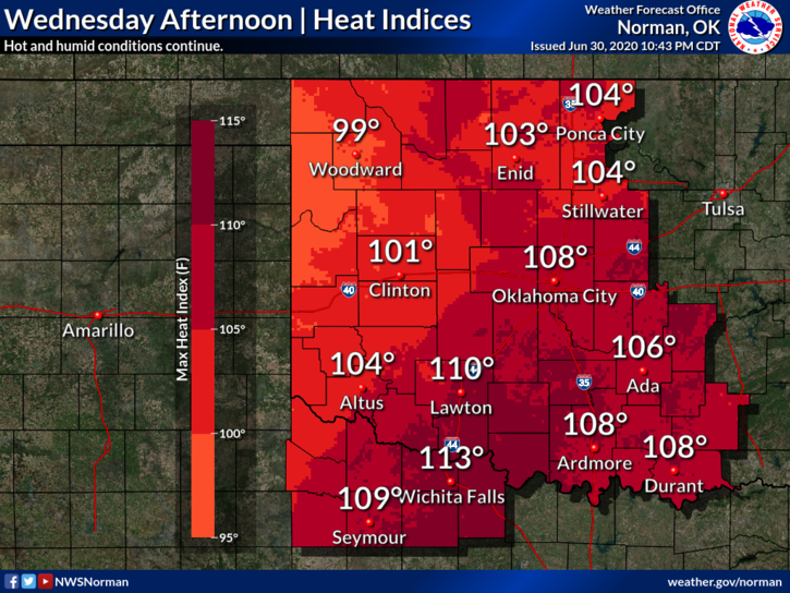
1- HEAT ADVISORY IN EFFECT UNTIL 8 PM THURSDAY EVENING. Use EXTREME CAUTION while working outside. Parameters today will be about the same as yesterday except the winds shouldn’t be near as strong. High temps will be around 104 with the HEAT INDEX near 110. There will be an outside chance for a stray storm later today too. If storms occur, strong/damaging downbursts, per guidance, will be the main threat.
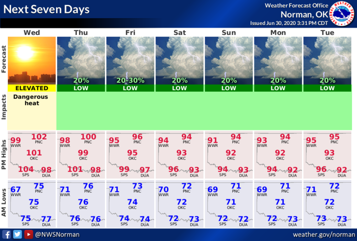
2- Overall, welcome to July and the heat moves on. Here is your forecast from the NWS/NORMAN;
TODAY- Isolated showers and thunderstorms after 4pm. Sunny and hot with a high near 103. Heat index values as high as 110. West southwest wind 5 to 15 mph. Chance of precipitation is 10%.
TONIGHT-Isolated showers and thunderstorms before 10pm. Partly cloudy with a low around 75. South wind 5 to 10 mph. Chance of precipitation is 20%
DIRECTORS COMMENT
The heat can be a dangerous thing and many folks don’t understand the dangers. Most won’t until they collapse from heat exhaustion. The kicker here is that once that happens, you’ll be more susceptible to heat issues. This is something that could stay with you for years. This is why we stress the fact of hydration during these times and as we get hotter through the summer, it’s important to make sure you, your family, and don’t forget your pets, know their limits in the heat. WE ALL HAVE LIMITS when it comes to the heat. The closer you get to that limit, the closer you come to a possible bad outcome. STAY SAFE!!
HAVE A GOOD DAY!!
MIKE