FROM GARFIELD COUNTY EMERGENCY MANAGEMENT-THURSDAY JULY 20, 2017
HEAT ADVISORY IN EFFECT FROM NOON TODAY TO 8 PM CDT FRIDAY.
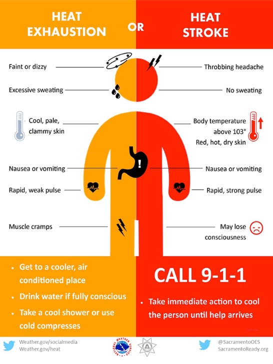
I feel most of you understand what a HEAT ADVISORY means. If you have had issues in the past from hot conditions, STAY INSIDE. Temps will be in the lower 100’s today and combined with humidity, the HEAT INDEX will be around 107 or so. Keep a CLOSE eye on the kids if they are outside and make sure your pets have shade if kept outside and plenty of fresh water.
Even though the foliage out there looks green, it is slowly drying up. This means the FIRE DANGER IS INCREASING. With the winds blowing at a steady pace, it won’t take much for fire to travel. BE EXTREMELY CAREFUL utilizing anything related to fire.
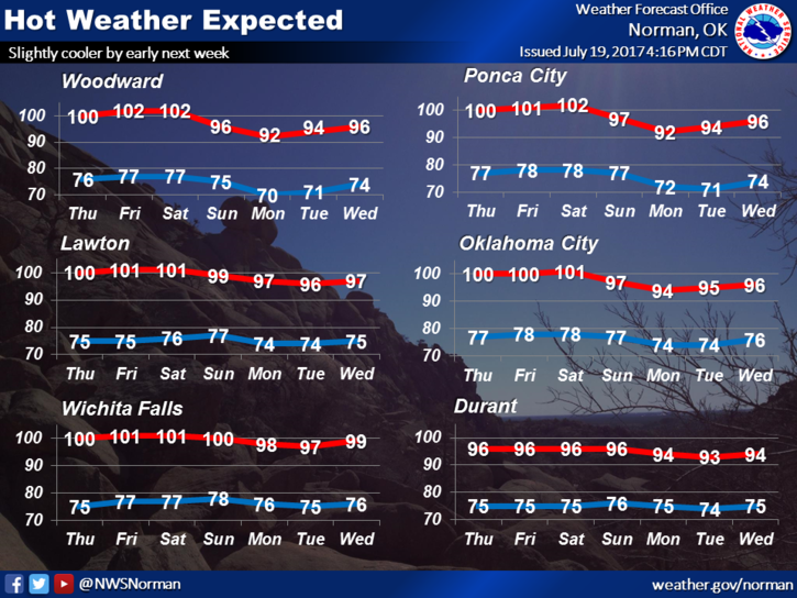
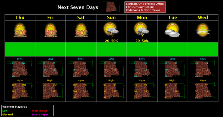
Here is your forecast from the NWS/NORMAN;
Thursday-Sunny and hot with highs around 103. Heat index values as high as 107. South winds 5 to 15 mph gusting to 21 mph.
Thursday Night-Mostly clear with lows around 79. South wind 10 to 15 mph gusting to 20 mph.
HAVE A SUPER DAY and STAY COOL!!
MIKE