0400L-THURSDAY OUTLOOK & INFO FROM GARFIELD CO. EMERGENCY MGMT-7/9/2020
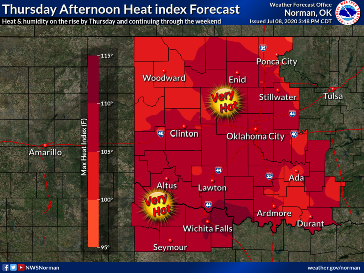
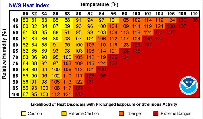
1- HEAT ADVISORY IN EFFECT FROM 1PM TODAY THROUGH 7PM ON SATURDAY. I spoke about the heat early this week so be prepared for extremely high HEAT INDEX temperatures. Pace yourselves out there.
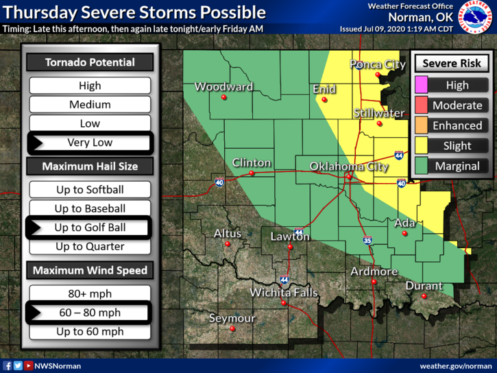
2- We are also in a SLIGHT RISK area for severe weather later tonight as a storm complex moves southeast through Kansas. There is a complex in central Kansas right now as I type but it appears that we may miss any precip out of it. Storms could back build but we’ll see what happens. If storms do occur this morning, strong winds and quarter size hail would be the main threats. Tonight may be a different story so as the forecast modifies during the day, I will send out information over our GARFIELD COUNTY EM app as needed. Our app is in both the iTunes and Google play stores.
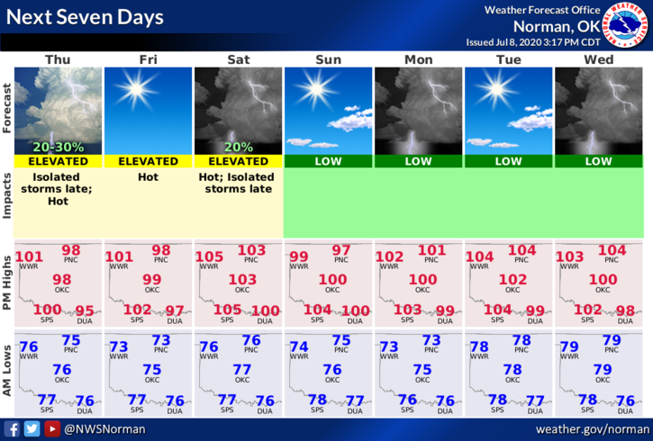
3-Here is your forecast from the NWS/NORMAN;
Today-Partly cloudy. A slight chance of thunderstorms early in the morning. Highs around 100. Southeast winds 10 to 20 mph. Chance of thunderstorms 20 percent.
Tonight-Partly cloudy. A chance of thunderstorms in the evening, then a slight chance of thunderstorms after midnight. Lows in the mid-70s. Southeast winds 10 to 20 mph. Chance of thunderstorms 40 percent.
I’LL ADVISE AS NEEDED. HAVE A GOOD DAY!!
MIKE