0250L-THURSDAY OUTLOOK FROM GARFIELD COUNTY EMERGENCY MANAGEMENT-6/01/23
* Yesterday evening was interesting. Storms fired up in the Hennessey area along a trough and built northwestward and the rest is history. Some areas didn’t see any rain and a few others received around 4 inches of rainfall east of Bison. We also had some pea to dime size hail. In Enid we had around 1.5 to 2.5 depending on where you were and possibly more. The only bad thing about this rainfall is that it came so fast that most of it just ran off.
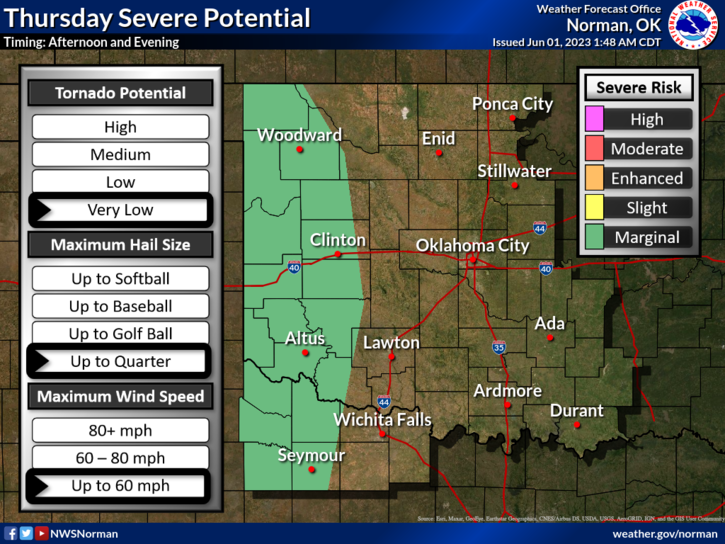
*The above stated, expect more of the same type of weather from now through the weekend. Torrential rainfall and hail along with gusty winds will be the trend. Some storms could become severe due to hail size and winds. We’ll see what happens.
* With the drainage channels full again, keep an eye out for snakes and keep the kids out of that water if possible. I may have to issue a SNAKE WARNING. Found 1 swimming illegally in the pool and another near the back door watching. Been a while since I found more than 1. They both are downstream now. 😊
* Overall, we’ll be ok so here is your forecast from the NWS/NORMAN;
Thursday- Partly sunny with a chance of thunderstorms. A chance of showers. Highs in the mid-80s. South winds 10 to 15 mph. Chance of rain 40 percent.
Thursday Night- Mostly cloudy with a chance of showers and thunderstorms in the evening, then partly cloudy after midnight. Lows in the lower 60s. Southeast winds 5 to 10 mph. Chance of rain 40 percent.
*FINALLY, post your rain totals here and be sure to download our GARFIELD COUNTY EM app. You’re not prepared without it!
HAVE A GOOD DAY!